An environmental disaster may have been averted as images from ESA's Copernicus fleet of satellites show the giant iceberg A-68a turning away from South Georgia Island and starting to break up into smaller bergs.
One of the largest icebergs ever recorded, A-68a broke away from Antarctica's Larsen-C ice sheet in July 2017. Though it covered a remarkable 2,187 square miles (5,664 sq km) and was on average 761 feet (232 m) thick, it rapidly faded from the public consciousness as it floated north for three years.
Then, in 2020, satellite images and military reconnaissance flights showed that, though the iceberg had lost over 30 percent of its original size, it was on a collision course with South Georgia, which is home to sustainable fishing grounds and one of the world's largest marine conservation areas.
The fear was that A-68c might ground in the broad shallows that surround the island and cause large-scale environmental damage by interfering with the feeding patterns of the resident seals and penguins, tearing up the seabed, and flooding the sea with cold fresh water at a rate of 27,000 cubic feet (767 cu m) per second, or 12 times the output of the River Thames.
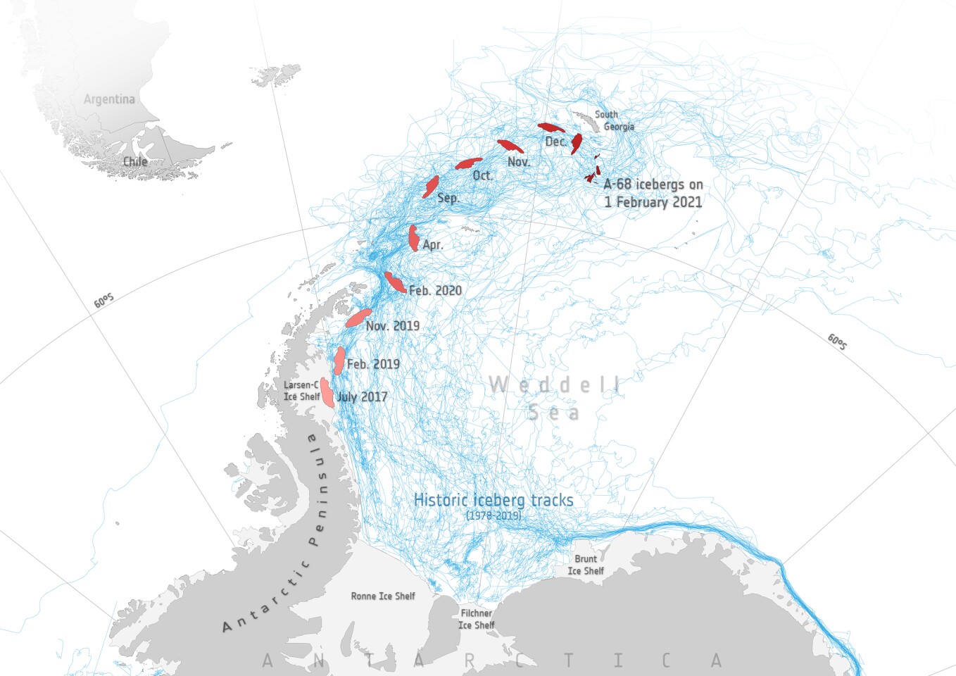
That appears to be off the cards as images from December 2020 on showed that the ocean currents were pushing the berg to the southeast and it was losing mass as a huge part of the iceberg calved away. More promising, it recently started falling apart as a new iceberg measuring 33 miles (53 km) long and 11 miles (18 km) wide, called A-68G, calved last week. A large crack then appeared and two more bergs, A-6H and A-68I, calved off.
As a result, A-68A is now "only" 37 miles (60 km) long and 14 miles (22 km) wide, and is 140 miles (225 km) from South Georgia and drifting south. The other bergs are also drifting apart, with A-68H 81 miles (130 km) from South Georgia and drifting north into open water.
According to ESA, the Copernicus satellites will continue to monitor the icebergs and the ocean currents carrying them along as they continue to break up and shrink.
Source: ESA