A robotic submarine has captured the first-ever images of the underwater foundations of one of the world's most significant glaciers. The remotely operated vehicle Icefin traveled beneath the Thwaites Glacier in Antarctica to learn more of the risk its deterioration presents to future sea level rises.
With a changing climate, the prospect of dramatic and unprecedented sea level rises is of growing concern, and the condition of the Thwaites Glacier is particularly troubling. Also known as Doomsday Glacier, it is one of the most unstable glaciers in Antarctica, swiftly flowing into Pine Island Bay in the Amundsen Sea. In recent decades, its rate of melting has accelerated, accounting for up to four percent of sea level rises in some areas and the fear is that if the glacier were to collapse, it could raise levels by as much as 25 inches (64 cm).
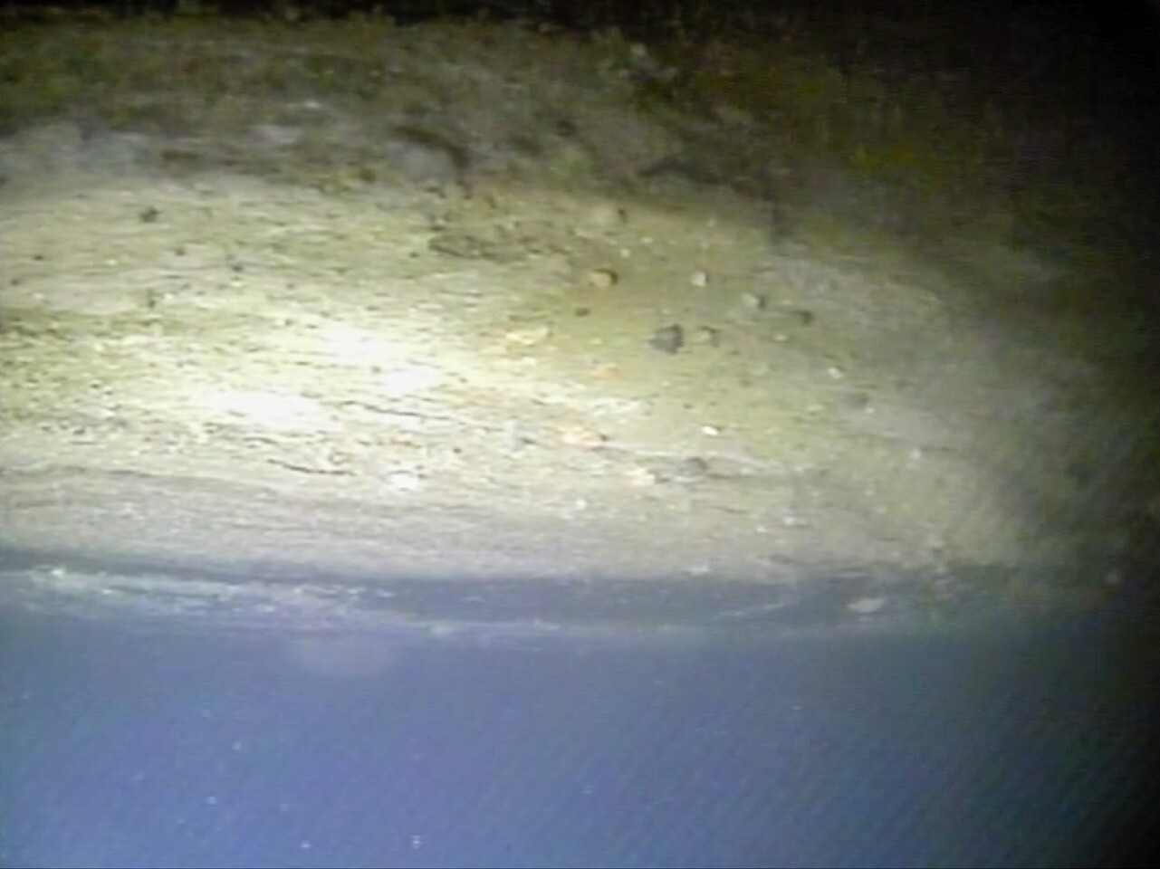
The key to assessing this threat is the grounding line, which is the line where the glacier, the seabed, and the sea meet. How far the ice shelf of the glacier projects over the line is an indication of the glacier's stability.
"Visiting the grounding line is one of the reasons work like this is important because we can drive right up to it and actually measure where it is," says Britney Schmidt from the Georgia Institute of Technology. "It's the first time anyone has done that or has ever even seen the grounding zone of a major glacier under the water, and that’s the place where the greatest degree of melting and destabilization can occur."
Built by Schmidt's team at a Georgia Tech lab, Icefin was used as part of a major effort by the US and British Antarctic Survey (BAS) to make an in-depth study of Thwaites. During this time, a BAS hot-water drill cut a hole through the ice to a level of 590 m (1,935 ft) to provide access to the grounding line.
"Icefin swam over 15 km (9.3 mi) round trip during five missions. This included two passes up to the grounding zone, including one where we got as close as we physically could to the place where the seafloor meets the ice," says Schmidt. "We saw amazing ice interactions driven by sediments at the line and from the rapid melting from warm ocean water."

The data recovered by Icefin and the rest of the mission is still being studied, with the results are expected to be released in the coming months or years.
“We know that warmer ocean waters are eroding many of West Antarctica’s glaciers, but we’re particularly concerned about Thwaites. This new data will provide a new perspective of the processes taking place, so we can predict future change with more certainty,” says Keith Nicholls, a BAS oceanographer.
The video below discusses the Icefin mission.
Source: Georgia Tech