
A multi-year field study of the deadly 2014 landslide that destroyed an entire community in Washington State is providing new insights into how such large-scale slides operate. A special team from the US Geological Survey did detailed measurements and sampling of the post-disaster site, allowing them to build a detailed timescale of the event.
At 10:36 am PDT on March 22, 2014, a 590-ft (180-m) tall face of one of the Cascade foothills that lined the North Fork Stillaguamish River valley in Oso, Washington, did something no one expected it to do. It moved. Burdened by four years of heavy rain and recent showers, the vast hill of alluvial deposits that had been plowed up and left behind at the end of the last ice age suddenly gave way.
Landslides in that mountainous region 50 mi (81 km) north of Seattle are not uncommon. In fact, they're almost routine and road and railway crews are used to getting a lot of clearance work each spring. However, most of these simple slumps stop close to where they started. But in Oso, nine million cubic meters (318 million cubic feet) of soil disintegrated into a cascade of mud that hurtled down into the valley with speed of an express train.
Within seconds, the hillside was gone and the mile-wide valley was filled with a mixture of rock, clay, splintered trees, and the remains of a dozen homes. In the disaster, 43 people died and 11 more were pulled alive from the mud. Not only was an entire rural community destroyed, but the State Route 530 road was obliterated, towns farther up the valley were cut off and had to make long detours to leave the area, and the river was dammed for weeks, resulting in extensive flooding followed by major downstream pollution as the mud and silt washed out. Meanwhile, the nearby town of Arlington became the base of relief operations for the Red Cross and National Guard with my daughter's school being turned into an evacuation center.
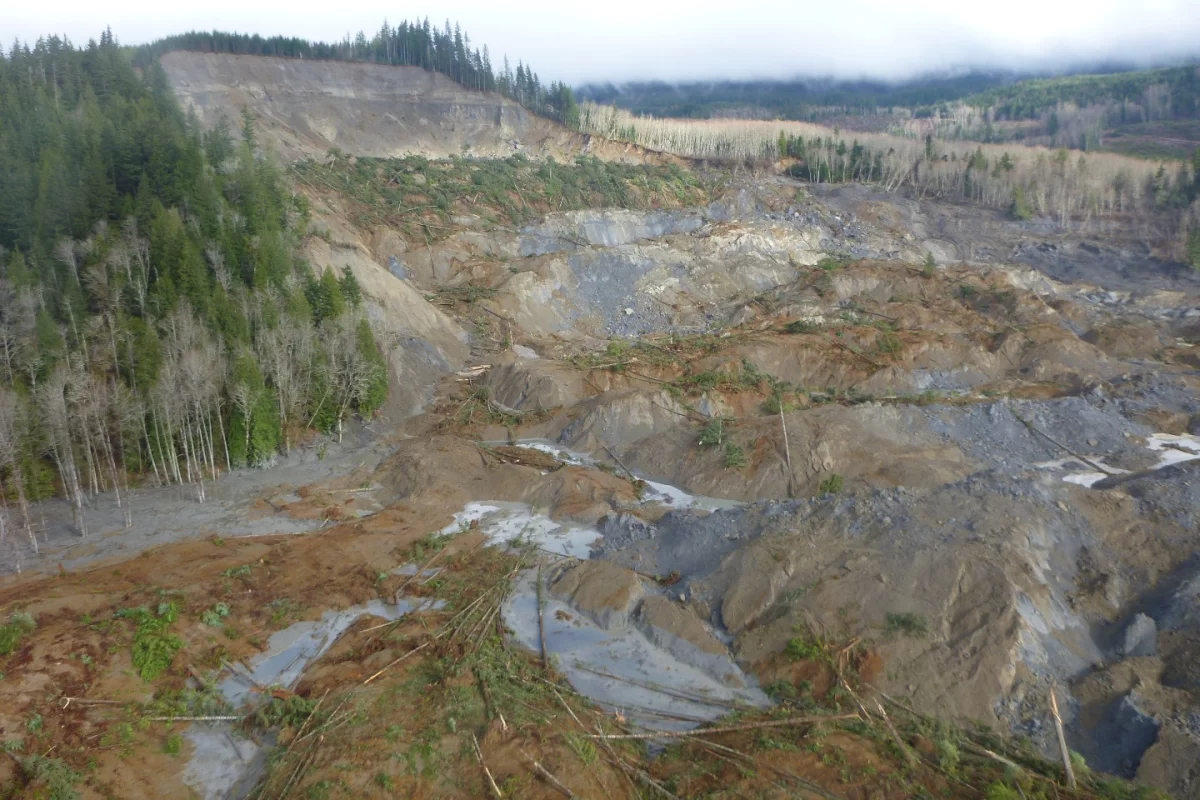
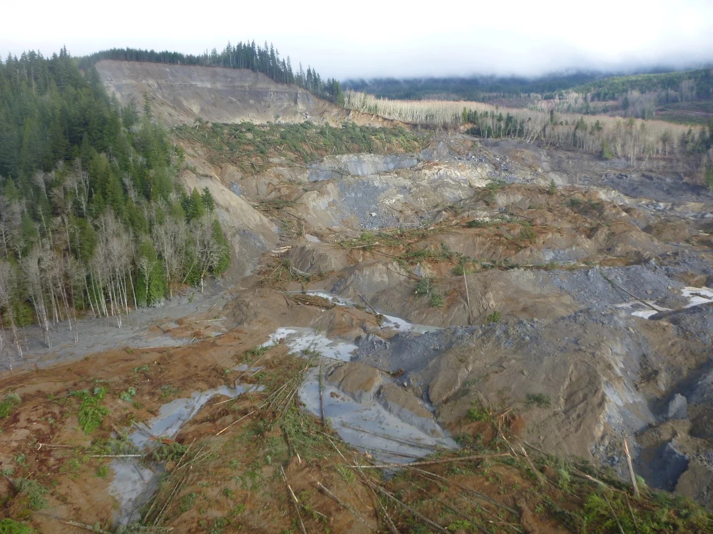
Five years later, the effects of the slide are still glaringly evident and, aside from the new road and a specially-made footpath, the area with its pools of quicksand is off limits to visitors. However, Brian Collins and Mark Reid of the US Geological Survey were allowed to enter the site many times to gather data from the constantly changing field of debris as they sought clues as to what happened and in what sequence.
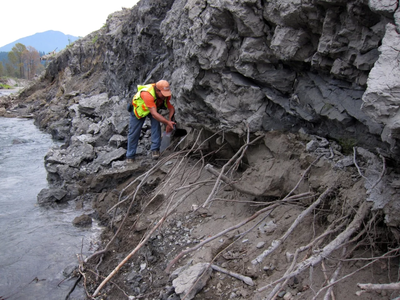
For three years, Collins and Reid recorded the geology and structure of the landslide before erosion and vegetation destroyed the evidence. This involved not only direct sampling, but also high-resolution aerial and satellite imagery, and airborne LiDAR data.
They found the reason the Oso slide was so devastating was because of how far the soil traveled, allowing it to build up a deadly momentum. As the slope collapsed, it stretched in a complex chain of events and then it hit the water-logged flood plain on the valley floor.
What happened next was something analogous to a geological phenomenon known as quick clay, which is a form of clay that is perfectly solid under normal loads, but when subjected to shearing forces, like earthquakes, loses all of its structural integrity and turns into a thick liquid. At Oso, a similar thing occurred. The survey found that the alluvial sands and gravels underwent a process called pore-pressure generation, in which high soil water pressure left behind hundreds of small sand cones as the water tried to escape. This process caused the base of the slide to liquefy and act like a gigantic slipway across the valley.
According to the team, this mechanism may be at work in slides in similar settings, providing geologists with a new tool for understanding and alleviating the effects.
The research was published in GSA Bulletin.