Researchers are using machine learning to analyze satellite radar data to detect icebergs in the Southern Ocean around Antarctica as a way to better understand their life cycle and environmental impact.
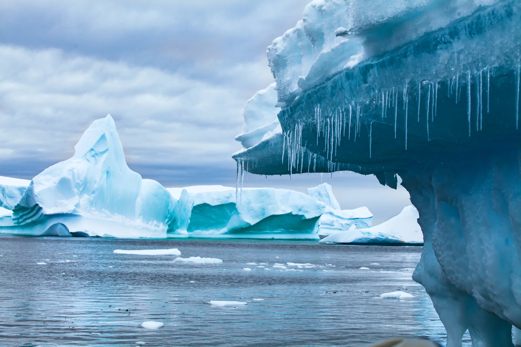
Icebergs may seem like something exotic and far away, but, as anyone who's seen Titanic can tell you, they can dramatically impact us when we least expect it. Only last week, the world's largest iceberg, called A23a, which is over twice as big as Greater London, broke free from the seabed after being stranded for almost three decades and is floating north in the Antarctic Ocean. Meanwhile, many thousands of smaller bergs are constantly calving away from the Antarctic ice shelf and floating out to sea.
The effect of all these bergs is not just to act as a hazard to shipping. As they melt over decades, they release cold fresh water and nutrients that can alter the local ecology as well as the complex dynamics of ocean circulation, the break up of sea ice, and even global sea levels.
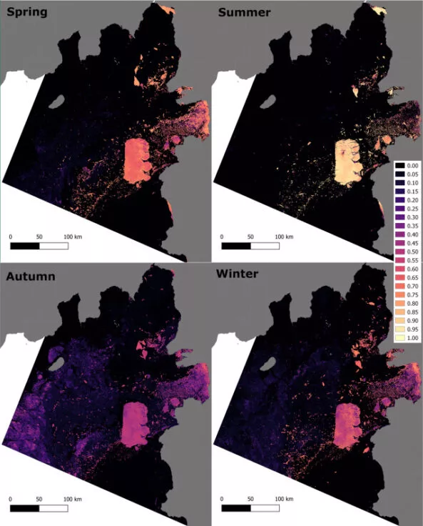
The problem is that all these chunks of ice bobbing about like in a gigantic mint julep are so numerous and move in such a chaotic fashion that it's hard to identify them, much less track them. To help with this, a team of scientists funded by the Alan Turing Institute have been using Synthetic Aperture Radar (SAR) from ESA's Sentinel-1 satellites, which can scan icebergs night and day in any weather.
The radar data isn't new, but what is is using an unsupervised AI algorithm to analyze readings gathered from October 2019 to September 2020, which identified almost 30,000 bergs measuring about 1 km² (0.4 miles²) or less in the Amundsen Sea Embayment in West Antarctica at the calving front of Thwaites Glacier.
The hope is that by accurately detecting and tracking icebergs, it will be possible to develop a digital twin of the Antarctic sea that will lead to a better understanding of the complex physics of how the ocean, ice, and atmosphere interact with one another.
“The technology we used to develop this tool is already used quite commonly for medical imaging and so we are excited to apply the same technology to the complex features seen in SAR satellite images of the polar oceans," said Ben Evans of the British Antarctic Survey (BAS) AI Lab. "The method we used is as accurate as the other alternative iceberg-detection methods, and outperforms most, without the need for human input. This means it can be easily scaled up beyond our study area and even provide near real-time monitoring."
The study is published in Remote Sensing of the Environment.
Source: BAS