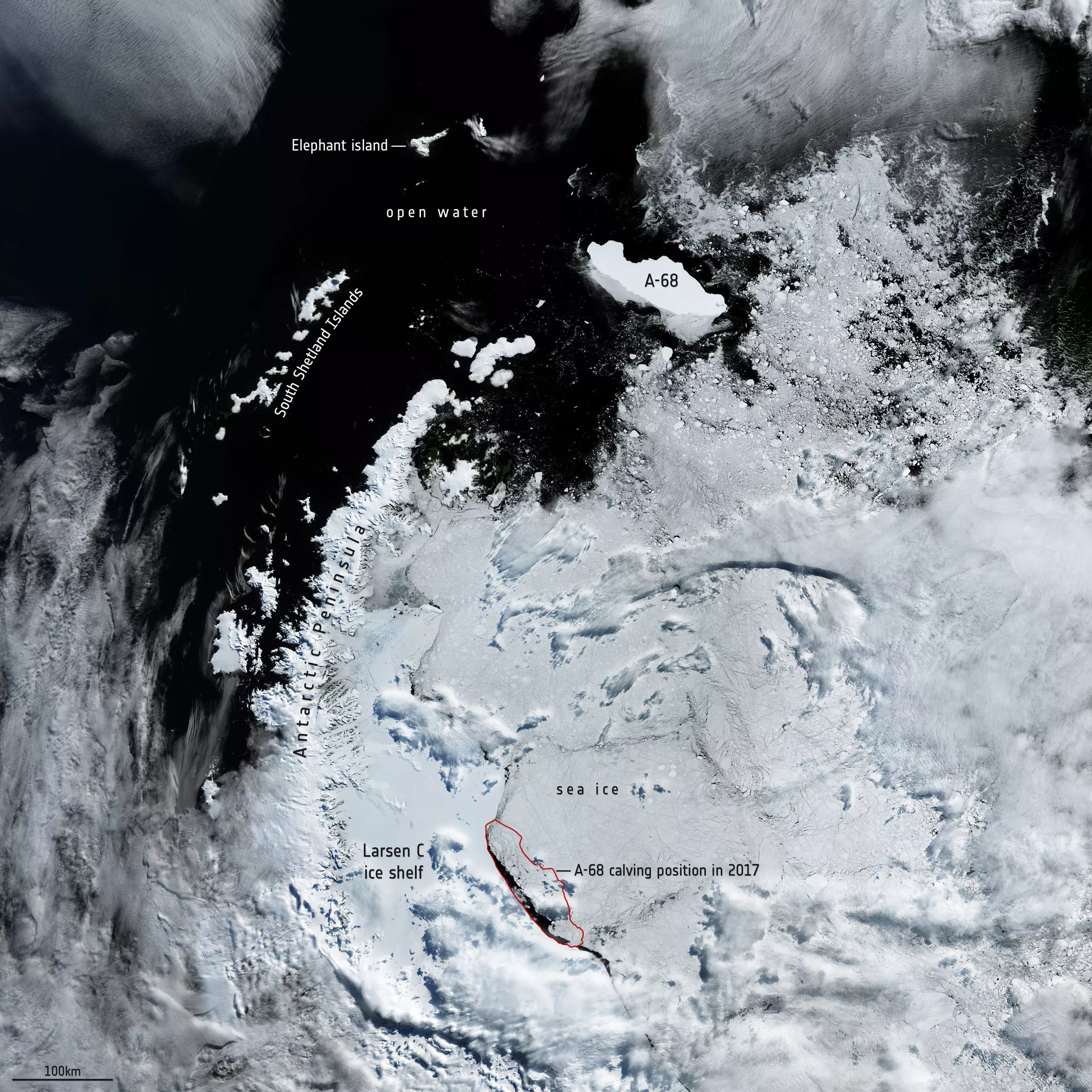


On 12 July, 2017, one of the biggest icebergs ever seen broke off from the Antarctic mainland. Now on the third anniversary of the event, satellite data has shown that the berg has traveled over 1,000 km (620 mi) and managed to stay relatively intact.
The calving event didn’t happen overnight – scientists watched for years as the rift grew across the surface of the Larsen C Ice Shelf. When it finally separated, the resulting iceberg, named A-68, was one of the largest ever recorded, measuring some 6,000 km2 (2,300 mi2). It was relatively thin however, measuring just a few hundred meters thick.
A mass that big could cause some serious havoc if it were to drift into shipping lanes, so satellites like Copernicus Sentinel-1 have been keeping an eye on A-68 ever since, watching where it went and how much ice it lost on the way.
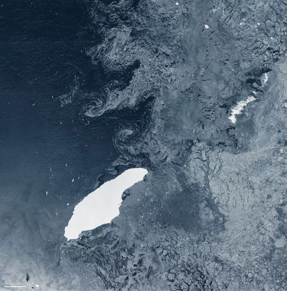
A-68 reportedly spent much of the first two years floating around near the ice sheet it broke off from, because it was boxed in by other sea ice. During that time, it lost a small chunk of ice, which came to be called A-68B. The original berg was renamed A-68A.

By September 2018, it finally managed to pivot away from the mainland and begin floating away. In February 2019, A-68A finally made it out into open waters, and began drifting north, alongside the Antarctic Peninsula. In April 2020 it lost another chunk, dubbed A-68C.
With a clearer path its pace accelerated, eventually driving it past the tip of the Peninsula and up towards the South Orkney Islands. As of July 5 this year, the iceberg had traveled a total of 1,050 km (652 mi) since it calved off the Larsen C Ice Shelf. Now that it’s ventured into more turbulent and warmer waters, A-68A is expected to start breaking apart a bit faster.
Unfortunately, A-68A might be speeding up ice loss in the area. After the iceberg broke off, it was noted cracks were heading towards a feature called Bawden Ice Rise, which is an important anchor point for the rest of the ice shelf.
Satellites like Copernicus Sentinel-1 will no doubt continue to observe A-68A and the remaining ice shelf for changes.
Source: ESA