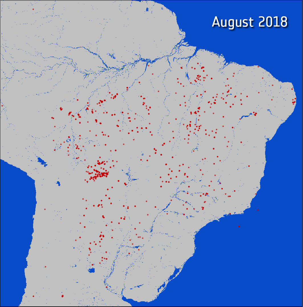
Data collected by ESA’s Copernicus satellites has highlighted an almost fourfold increase in the number of fires devastating the Amazon rain forest in August this year, as compared to the same period in 2018. The fires have destroyed the habitats of countless species, and released massive amounts of carbon dioxide and carbon monoxide into the atmosphere.
The Amazon rain forest spans over 5.5 million sq km (2.1 million sq mi), and spreads across the borders of several South American countries, making it the largest rain forest on Earth. It is a place of astounding ecological diversity, and plays host to countless species of all shapes and sizes that have evolved to thrive in their given environment, whether it be at the top of the forest canopy, or deep beneath the ground amongst the branching roots.
This sprawling leafy realm draws millions of tons of carbon out of the atmosphere each year, replacing it with oxygen via photosynthesis.
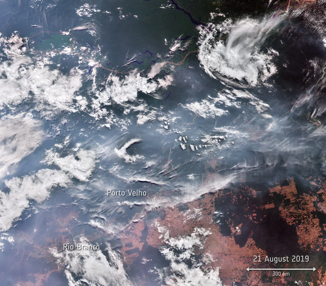
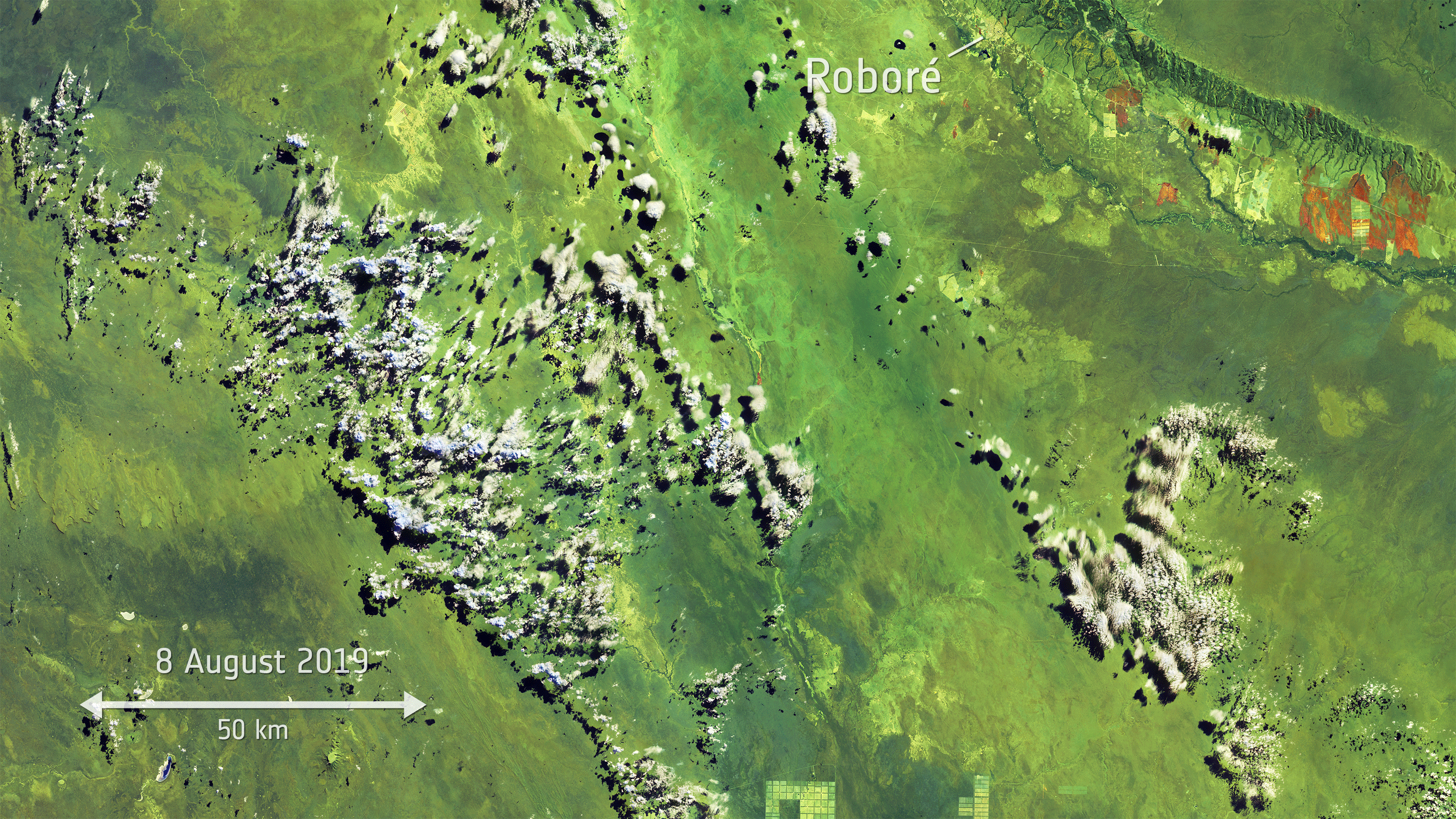
In recent decades, rampant deforestation has led to the destruction of vast swathes of the Amazon rain forest. This human interference, in conjunction with anthropogenic-led climate change, is thought to have made the region more susceptible to the fires that occur naturally during Brazil’s dry season, which starts in July each year and runs through to October.
Satellite data collected by the ESA’s Copernicus Sentinel-3 satellites in the month of August has highlighted a dramatic increase in the amount of fires breaking out in the rain forest.
Between August 1st and 24th, the sensors mounted on the orbiting satellites detected a staggering 3,951 fires scouring the Amazon. This is an almost fourfold increase compared to the same period in 2018, during which 1,118 fires were recorded.
“By processing 249 images for August 2018 and 275 images for August 2019, we are able to see the incredible number of fires burning in the Amazon,” says ESA’s Olivier Arino. “This was achieved by the World Fire Atlas night time algorithm, in order to avoid any possible false alarms with the daytime algorithm.”
It is estimated that 228 megatonnes of carbon dioxide has been released by the fires into the atmosphere. Powerful winds are reported to have blown the resulting smoke thousands of miles to the Atlantic coast.
In the wake of the crisis, the Copernicus Emergency Management Service has been activated, under which satellite imagery and geospatial data is provided free of charge to help inform authorities working to monitor and help tackle the disaster.
Source: European Space Agency