GPS
-
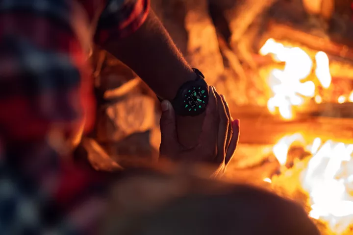 Garmin has launched a new Instinct adventure watch called the Crossover that takes a hybrid approach by combining GPS smartwatch functionality with classic analog timekeeping courtesy of luminescent hour markers and watch hands.
 -
 The movements of the Sun, Moon and stars have long been used to keep track of time, and now engineers from the University of Tokyo have proposed a new way to use the cosmos to precisely track time, using showers of particles from cosmic rays.
 -
 In 2018, Garmin launched the ultralight inReach Mini two-way emergency communicator. Now it updates the tiny, satellite-based survival tool into the all-new Mini 2, a palm-sized device with more power for saving your bacon in the backcountry.
 -
 Sandia National Laboratories is developing an avocado-sized vacuum chamber made out of titanium and sapphire that could one day use quantum mechanical sensors to provide GPS-grade navigation without the need for satellites.
 -
 BAE Systems has developed the world's smallest, lightest, and most power-efficient military M-Code GPS receiver. About the size of a postage stamp, the MicroGRAMTM-M can be installed in handheld devices and is resistant to jamming and spoofing.
 -
 Velotton introduced the fairly lightweight Vekkit conversion kit last year for those who can't afford the often high price tags of dedicated ebikes, and now version two has been announced – adding a GPS+LTE module and new battery options.
 -
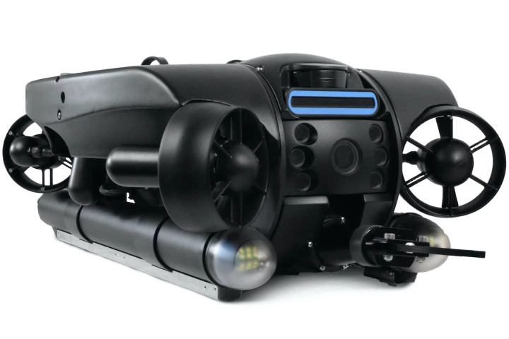 GPS doesn't work underwater, which means that keeping track of a submersible's whereabouts can be difficult. A new ROV (remotely operated vehicle) still manages to show up on Google Maps, however – plus it has a cool rotating head.
 -
 A new prototype Companion Collar smart collar is being developed by the CSIRO's digital specialist arm, Data61, and agtech company Ceres Tag that will allow pet owners to track their animal across both long and short distances.
 -
 China has reached an enormous milestone with the successful testing and commissioning of the 55th and final satellite in its BeiDou-3 global positioning system, a competitor to the American GPS system with the capability to send short messages.
 -
 The Global Position System (GPS) has turned 25 years old. Operated by the US Space Force, the constellation of navigational satellites went fully operational on April 27, 1995, though US Space Command made the formal announcement in July of that year.
 -
 In-car satnav systems and mobile mapping apps have made it much easier to travel from one place to another without getting lost, but a new innovation promises to help fix a remaining pain point – getting in the right lane at intersections.
 -
 Commercial aircraft are already guided in for automatic landings at large airports, as their autopilot follows radio signals transmitted by ground-based antennas. Such auto-landings currently aren't possible at small airports, although that could be about to change, thanks to a new system.
Load More