Mapping
-
 Parrot's newly-announced S.L.A.M.dunk is a development kit for drones equipped with hardware that suggests a particular focus on obstacle avoidance and navigation, but doubles as a desktop computer as well.
 -
 Researchers at Carnegie Mellon University have come up with a novel way of improving robots' inspection and manipulation skills. The team fitted a small camera to the hand of the machine, allowing it to quickly track its environment and the position of the hand in real time.
 -
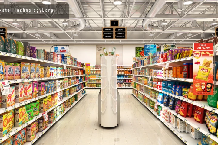 In large supermarkets carrying thousands of goods, even employees can have trouble remembering where everything is. That's why Toronto's 4D Retail Technology Corp. developed the stock-taking, store-mapping 4D Space Genius robot.
 -
 The Shipboard Autonomous Firefighting Robot, as its name implies, is designed to help human crews fight fires in the close confines of naval vessels. In order to get to those fires quicker, it may ultimately receive some help itself from an autonomous drone.
 -
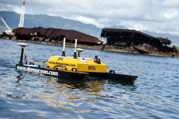
 Antarctic scientists have made big gains in our knowledge of Antarctic sea ice thanks to an autonomous underwater vehicle that produced high-resolution 3D maps beneath previously-inaccessible ice floes. The new data suggests the ice may be thicker and more deformed than previously thought.
 -
 An ambitious project at Pearl Harbor in Hawaii is rendering 3D models of sunken ships from World War II for use in keeping track of changes over time to their structures as part of an effort to bring greater insights to this tragic historical event.
 -
 When we first heard about the NavVis system a couple of years ago, it was being developed for indoor navigation. Now, the technology has been expanded to the point that it could give Google Street View a run for its money.
 -
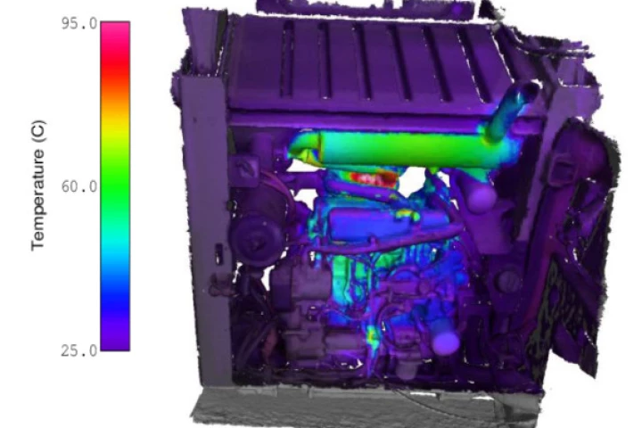 Australia's CSIRO has developed a prototype tool called HeatWave that is a lightweight, high-resolution 3D scanner that is claimed to be not only easy to carry, but easy to use as well.
 -
 Sometimes it's preferable to take the scenic route to a destination rather than the shortest. It's not an option available on online maps, but a new concept has shown that it could be. Yahoo researchers have found a way to quantify the beauty of different places and use the data to give directions.
 -
 Have you ever wished you were an alien or a shark? Well, sorry, but you're never going to get to be one. The free Nito app, however, does let you appear as those characters or others, in recorded 15-second videos.
 -
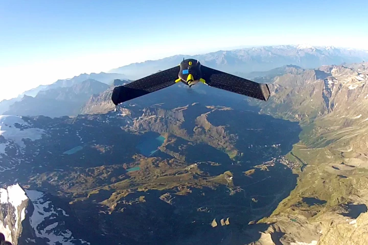 Explorers have mapped the surface of the iconic Matterhorn painstakingly by foot, by satellite, and now by drone, thanks to a small fleet of eBees launched by senseFly and Drone Adventures. The mission not only proved the eBee’s capabilities, but generated a data-rich 3D model of the mountaintop.
 -
 Last November, we heard about Lehmann Aviation’s LA100, a small and fully autonomous UAV designed to capture aerial images with a user-supplied GoPro camera. Now the French company is offering two new models that go farther and stay in the air longer.
Load More