Mapping
-
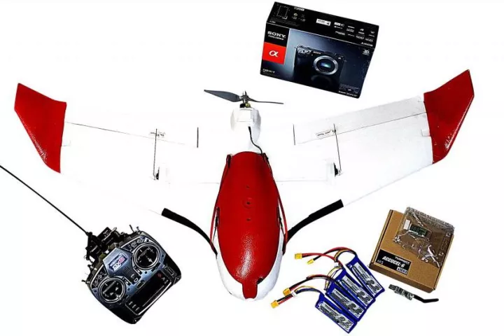 The Aeromapper X5 UAV is launched by hand, flies and performs aerial mapping autonomously, then parachutes back to the ground.
 -
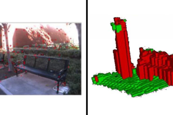
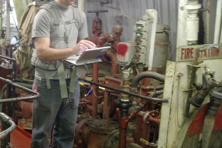 The backpack-mounted Enhanced Mapping and Positioning System (EMAPS) can be used to map locations that are inaccessible to GPS.
 -
 Google Maps used backpack-mounted cameras to capture stunning 360-degree panoramic images of the Grand Canyon that can be explored in Street View.
 -
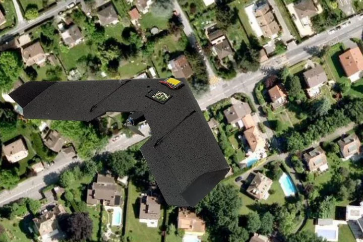
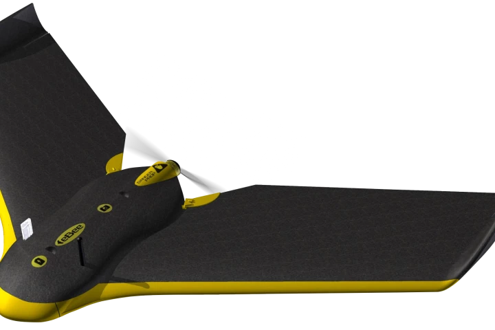 Swiss sensor manufacturer senseFly is about to release its new unmanned aerial vehicle, the eBee.
 -
 Gizmag takes a look at the new features ushered in with the release of iOS 6.
 -
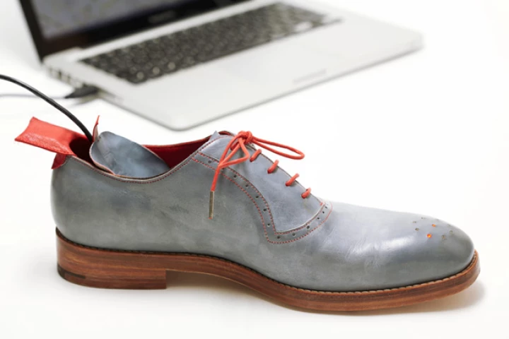 No Place Like Home GPS shoes direct the wearer home when there's no yellow brick road available.
 -
 Local magnetic field anomalies can be used for indoor positioning independent of external infrastructures.
 -
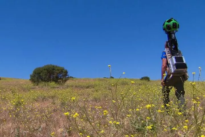 Google's Street View Trekker will bring Street View to those areas, such as canyons, ruins or national parks, that can only be reached on foot.
 -
 The FINIS Hydro Tracker GPS device allows open water swimmers to map their swims and record performance data.
 -
 Researchers at the University of Southern California have developed a 'guide vest' that works in conjunction with a helmet-mounted camera and special software to let wearers 'see' the world through tactile feedback.
 -
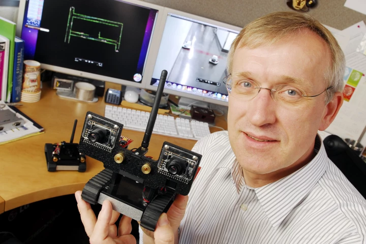 The MAST research project is working on developing tiny autonomous, collaborative robots, that could be used to map out hazard environments for humans.
 -
 The Swinglet CAM can take off, snap aerial photos along a chosen route and then land, where the operator can upload the images to a waiting notebook.
Load More