NOAA
-
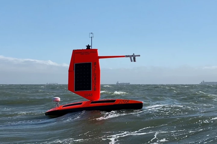
 Earlier this year, Saildrone joined forces with NOAA to launch sensor-packed unmanned surface vehicles into paths of hurricanes in the Atlantic Ocean to gather data. Now one of those drones has captured footage from inside a Category 4 hurricane.
 -
 Though some folks chase storms for thrills or curiosity, there are also those who do so for scientific purposes. And it's the lattermost pursuit that will see a small fleet of unmanned surface vehicles deliberately head into hurricane territory.
 -
 The National Oceanic and Atmospheric Administration (NOAA) has released the first batch of images taken by the GOES-16 satellite, including a breath-taking image of Earth's full disk.
 -
 Researchers at the National Oceanic and Atmospheric Administration (NOAA) have completed a successful test flight of their Coyote Unmanned Aircraft System, a drone designed to retrieve important data from the eye of the storm to improve hurricane forecasting.
 -
 Japan's I-400-class subs were so large that they could each carry and launch three Aichi M6A Seiran amphibious aircraft. Now, for the first time since it was scuttled at the end of World War II, one of the sunken subs' aircraft hangars has been photographed.
 -
 Sunday's delayed launch means that NOAA's Deep Space Climate Observatory (DSCOVR) will wait at least a day before it can take up its job of helping protect Earth against solar flares.