Outdoors

ViewRanger outdoor GPS app combines mapping, social networking and trail guidebooks

ViewRanger outdoor GPS app combines mapping, social networking and trail guidebooks
ViewRanger puts the functions of an advanced outdoor GPS into an inexpensive Apple/Android app
View 21 Images
ViewRanger's website lets you design and download routes
1/21
ViewRanger's website lets you design and download routes
ViewRanger also serves as an advanced sports computer
2/21
ViewRanger also serves as an advanced sports computer
Trail guides include information and pictures
3/21
Trail guides include information and pictures
ViewRanger has partnered with several prominent publishers for its trail guides
4/21
ViewRanger has partnered with several prominent publishers for its trail guides
ViewRanger not only navigates the wilderness, but also gives you information about trails
5/21
ViewRanger not only navigates the wilderness, but also gives you information about trails
ViewRanger gives you access to a full set of US topographic maps
6/21
ViewRanger gives you access to a full set of US topographic maps
ViewRanger's maps are available in both USGS topo and shaded terrain views
7/21
ViewRanger's maps are available in both USGS topo and shaded terrain views
8/21
ViewRanger's maps are available in both USGS topo and shaded terrain views
9/21
ViewRanger's maps are available in both USGS topo and shaded terrain views
10/21
ViewRanger's maps are available in both USGS topo and shaded terrain views
ViewRanger's data includes 250,000 trails
11/21
ViewRanger's data includes 250,000 trails
ViewRanger's maps are available in both USGS topo and shaded terrain views
12/21
ViewRanger's maps are available in both USGS topo and shaded terrain views
ViewRanger is available for iOS and Android devices
13/21
ViewRanger is available for iOS and Android devices
You can order detailed trail guides through the app
14/21
You can order detailed trail guides through the app
ViewRanger gives you a variety of useful information
15/21
ViewRanger gives you a variety of useful information
ViewRanger's maps are available in both USGS topo and shaded terrain views
16/21
ViewRanger's maps are available in both USGS topo and shaded terrain views
17/21
ViewRanger's maps are available in both USGS topo and shaded terrain views
18/21
ViewRanger's maps are available in both USGS topo and shaded terrain views
19/21
ViewRanger's maps are available in both USGS topo and shaded terrain views
ViewRanger is available for iOS and Android devices
20/21
ViewRanger is available for iOS and Android devices
ViewRanger puts the functions of an advanced outdoor GPS into an inexpensive Apple/Android app
21/21
ViewRanger puts the functions of an advanced outdoor GPS into an inexpensive Apple/Android app
View gallery - 21 images

Imagine the power of a US$500 outdoor GPS built into a $5 app available on iOS and Android devices. In a nutshell, that's ViewRanger. The advanced mapping GPS app has been around for years in Europe and just launched in the United States.

When we first heard about ViewRanger, we weren't particularly optimistic - there are, after all, plenty of other GPS apps. After speaking with CEO Craig Wareham and seeing the app in action, we're much more excited.

ViewRanger originally launched in 2006. It's been available in countries around the world, but has been absent from the U.S. market until just last week.

Wareham explains: "We felt that now was the right time to come to the American market. There were a number of things that we felt we needed to get right to offer a good, quality solution: high quality, high resolution maps; good trail partner content; and also having the Web and mobile content together."

ViewRanger's data includes 250,000 trails

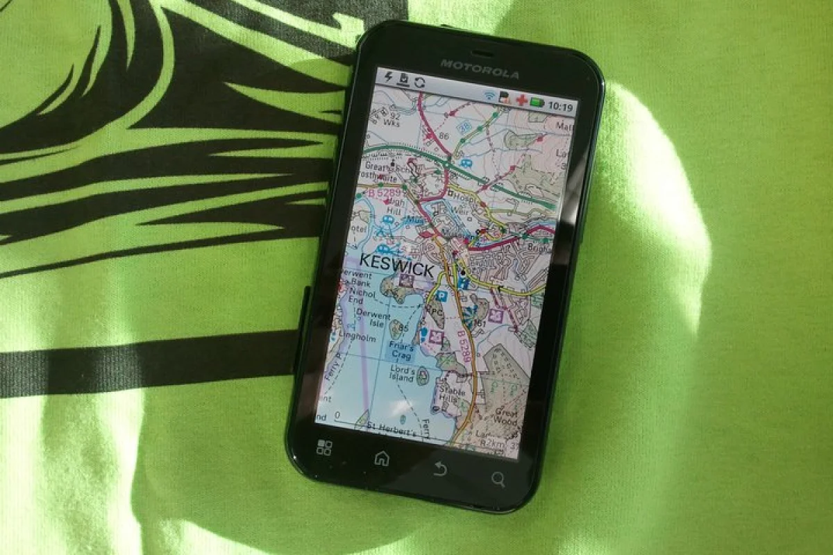
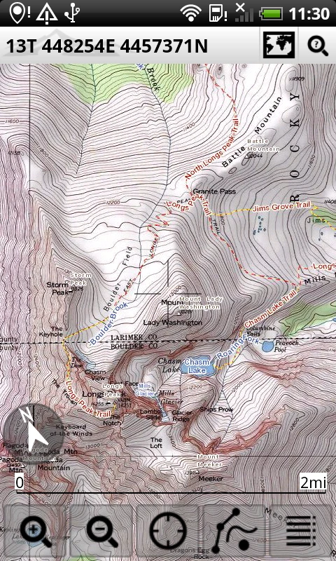
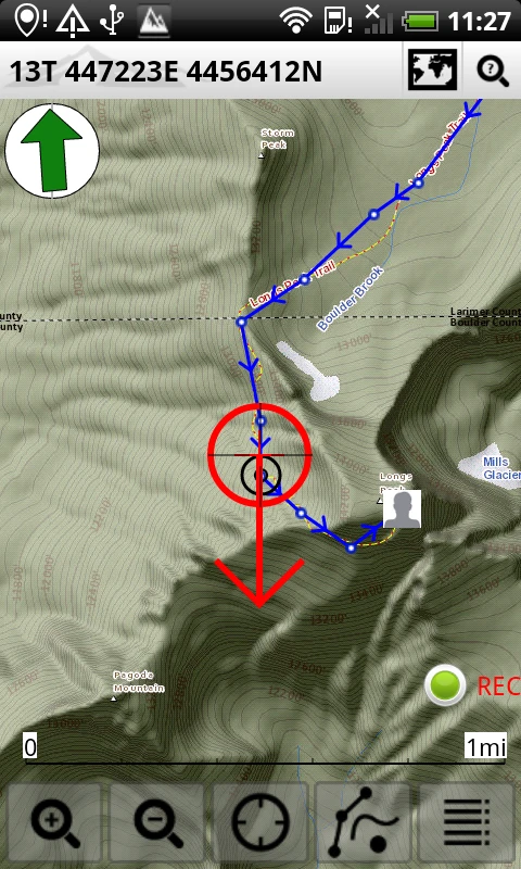
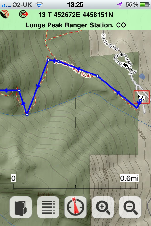
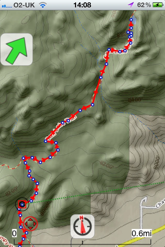
ViewRanger is an app for outdoors folks that essentially simulates the features of an advanced mapping GPS unit, and leverages your phone's mobile connection for some additional features. The app provides access to a full set of U.S. topographic maps that you can view in either traditional USGS topo or shaded terrain topo views. Overlaid atop the maps are 250,000 miles (402,000 km) of trails to provide you even more detailed navigation. You can easily access the maps on the go or download them to the device for offline use. Like a standalone outdoor GPS, ViewRanger both tracks where you've been (so you can navigate back) and allows you to set up routes ahead of time.

ViewRanger also offers in-app trail guides. For its United States iteration, ViewRanger partnered with guidebook publishers Monasha Ridge Press and Wilderness Press. The trail guides are pinned on the map and are available for purchase. Wareham told us that they typically cost between US$0.70 and $1.00 per guide. The guides provide trail descriptions, directions and pictures straight out of the publishers' guidebooks.

ViewRanger has partnered with several prominent publishers for its trail guides

In addition to the paid premium trail guide content, you can get less formal trail information through ViewRanger's online network at My.Viewranger.com. The website's tools allow users to build trail guides and offer them for free or for a paid download.

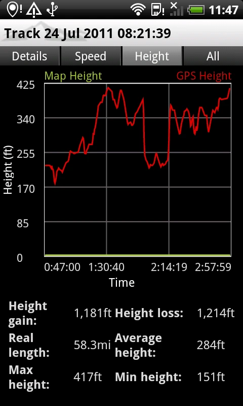
ViewRanger features an integrated sports computer that calculates statistics like trip time, speed, altitude gained and distance traveled. The app also has an integrated location-sharing feature called Buddy Beacon (internet required). This lets you share your location with friends and contacts, and displays the location of other users on your device. You can also connect your Twitter feed to the Buddy Beacon, so that you can share thoughts and pictures in addition to your location.

All that functionality is available for the somewhat staggering price of $4.99. The app easily syncs between devices and can be transferred to a new phone or tablet when you replace your current device.

ViewRanger is pretty comprehensive as it is, but it should gain even more functionality in the future. Wareham said that the company has development mapped out through 2020 with some interesting features to come. We couldn't pry specifics out of him, but he did let the term "augmented reality" slip - perhaps a feature where you can get trail information and points of interest using the phone's camera.

The video below provides a closer look at the app. You can also find more information at ViewRanger.com

View gallery - 21 images
2 comments
2 comments
Tim Cooper
Been using Viewranger for years now, on various devices. Great app. If you plan on using the Buddy Beacon, take a look at www.shareyouradventure.com. Uses Viewranger\'s API to create live maps with tagged Tweets, pictures, video, etc. Adaptable to both single and multi day maps. All laid out in a much better format than Viewrangers own site. (and no, its not my site!)
Desmond FLechner
I\'ve just installed it and will see if it covers my region in The Netherlands... and if it does, does it automatically overlaps into neighboring countries under the GPS protocol or it requires my Internet package to stay on which then could compromise heavy roaming charges to my account?