
According to the World Bank Group, almost 900 million people around the world live on less than US$1.90 a day. Although such an enormous global issue, there's actually not that much concrete data available on the exact location of the world's impoverished zones. Stanford University researchers have come up with a method that could start to fill in some of the blanks, feeding satellite imagery into a machine learning algorithm to identify poverty-stricken areas across the African continent.
For many impoverished regions around the world, such as parts of Africa, there is only very limited, local-level information available on poverty, collected via on-the-ground surveys. While this method is time-consuming, expensive and results in limited data, high-resolution satellite imagery of such regions is collected almost constantly and possibly presents a more efficient way forward.
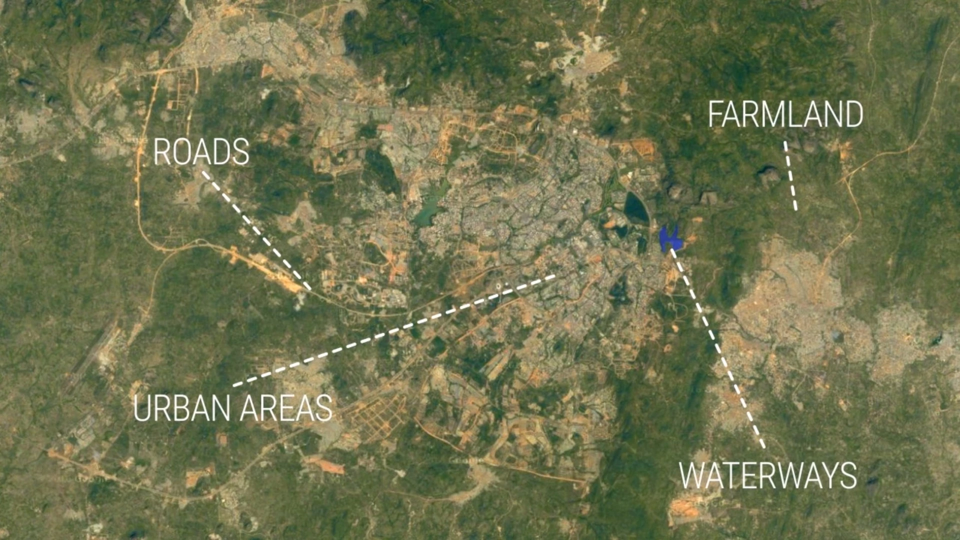
While satellite imagery in its raw form doesn't readily describe poverty distribution, the researchers came up with a way to use it for this purpose. They determined that daylight imagery alone wouldn't provide enough useful information, but by using a specially-designed machine learning algorithm, a mixture of night and daylight images could be used to paint a clearer picture.
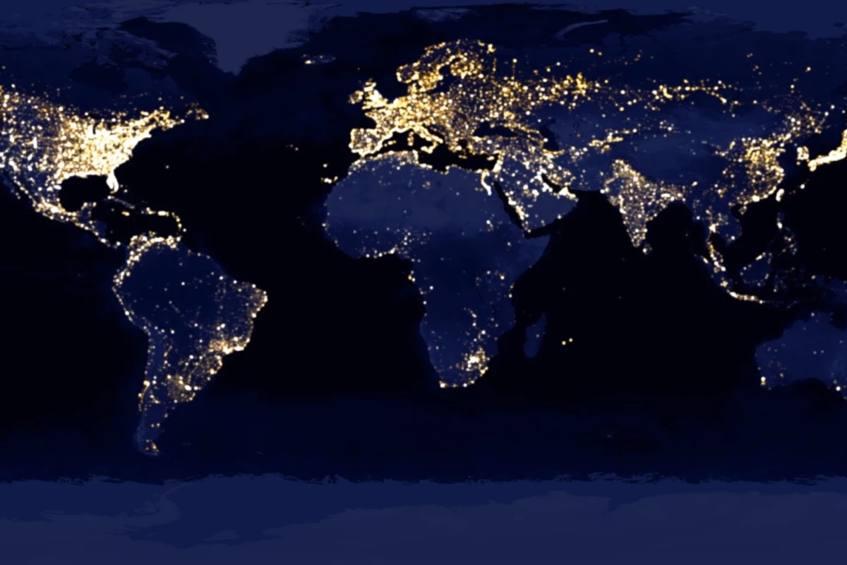
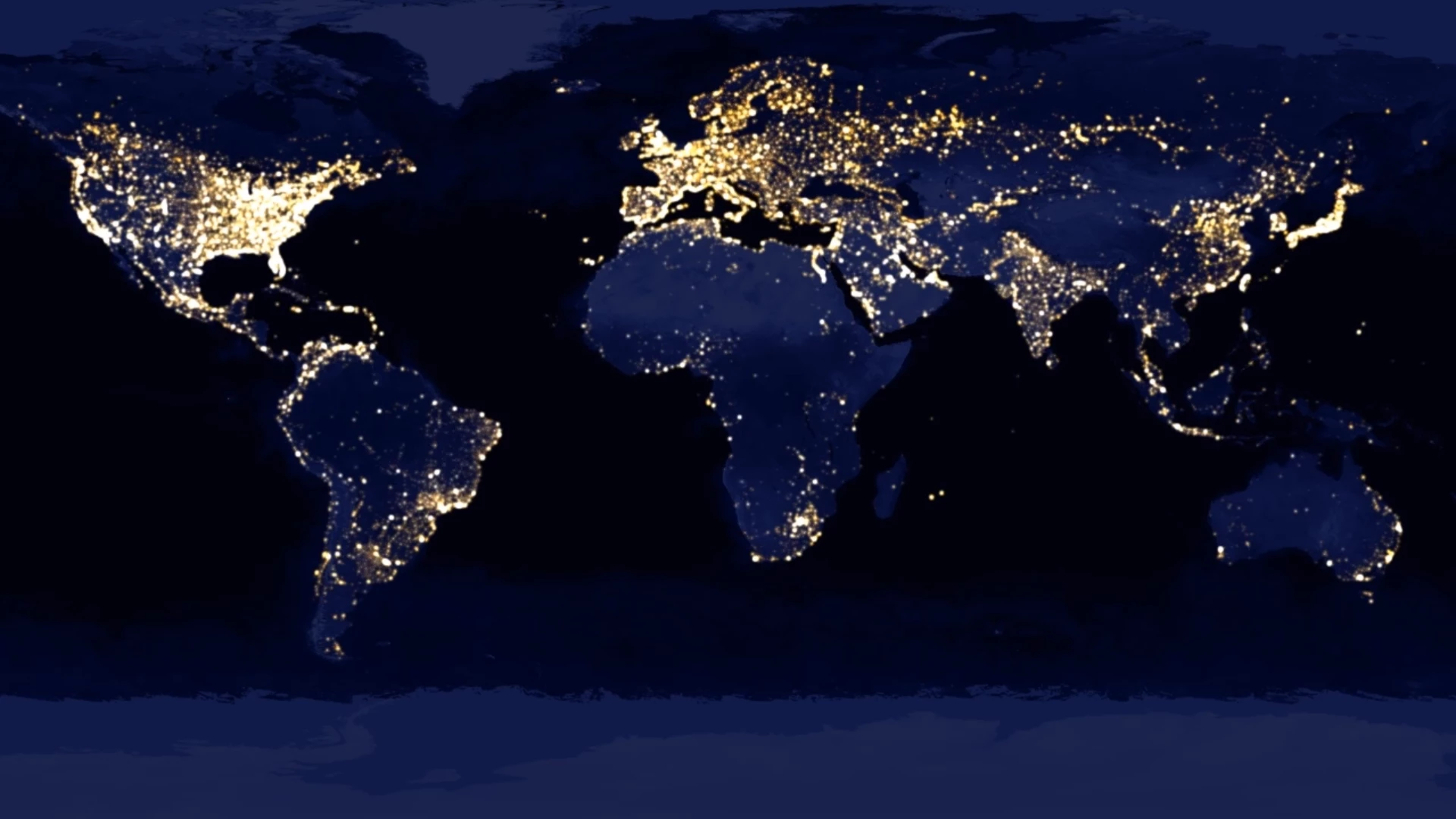
The night imagery forms a huge part of the equation, because brighter areas tend to represent more economically prosperous regions. By combining this information with images taken during daylight, the machine learning system was able to identify key features associated with economic development, such as roads and urban areas. The researchers were then able to use this information to accurately predict the wealth of an area, as measured in already available survey data.
"Without being told what to look for, our machine learning algorithm learned to pick out of the imagery many things that are easily recognizable to humans, things like roads, urban areas and farmland," says the study's lead author, Neal Jean.
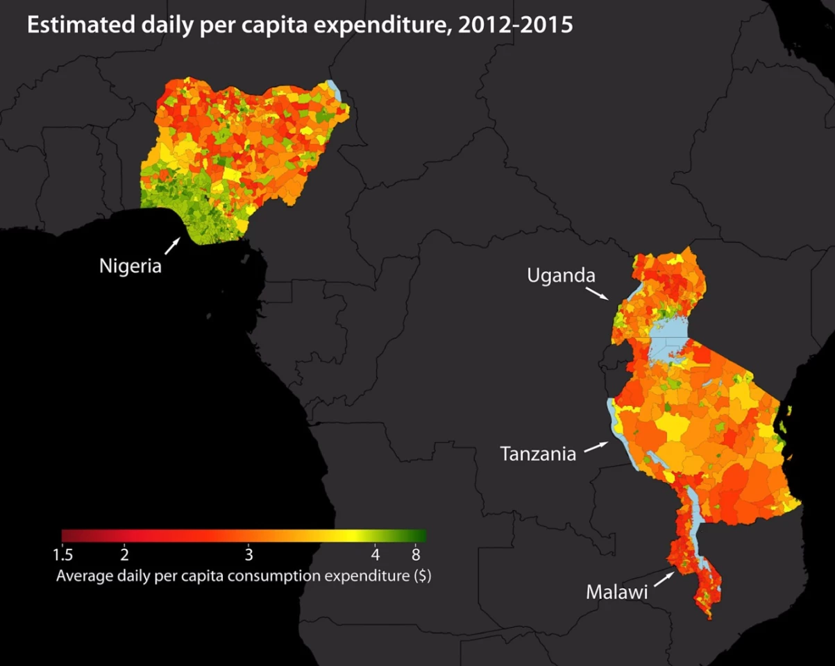
The researchers used this method to analyze satellite data covering Uganda, Nigeria, Tanzania, Nigeria, Rwanda and Malawi and say that it did a good job of predicting poverty distribution and outperformed existing approaches.
"Our paper demonstrates the power of machine learning in this context," says study co-author Stefano Ermon. "And since it's cheap and scalable – requiring only satellite images – it could be used to map poverty around the world in a very low-cost way."
The team published its work online in the journal Science. An overview of the Stanford University project can be seen in the video below.
Source: Stanford University