

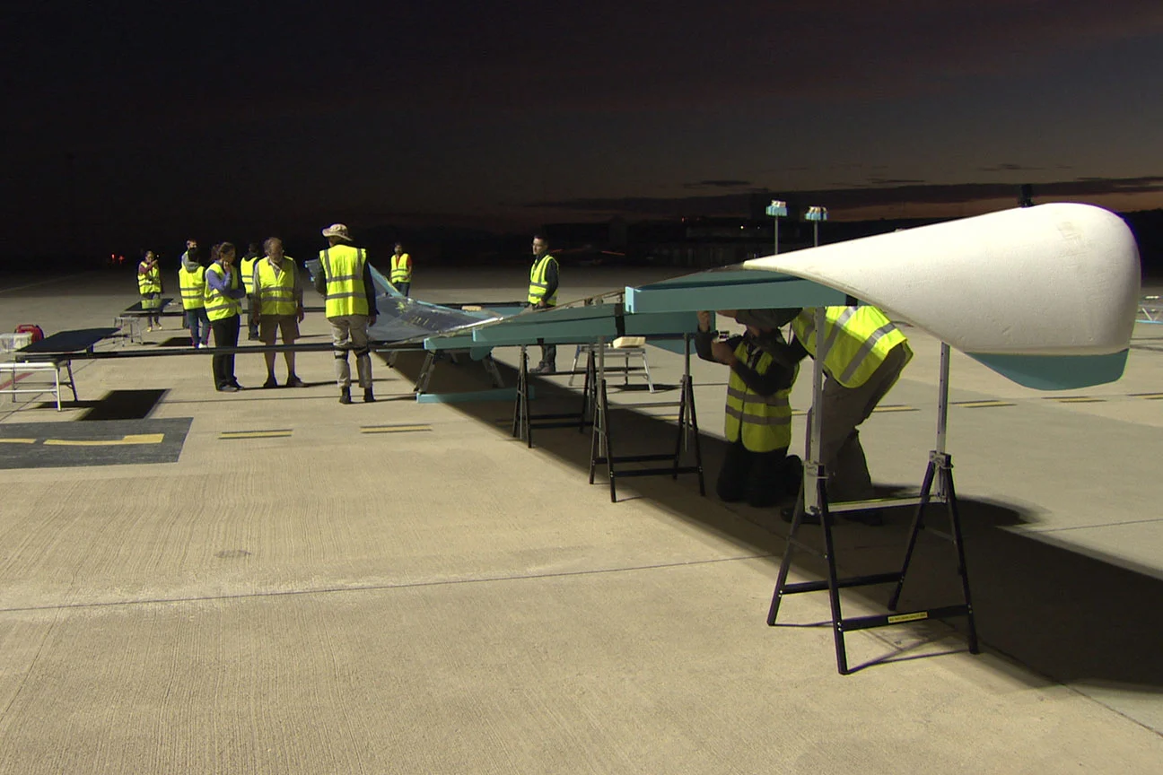
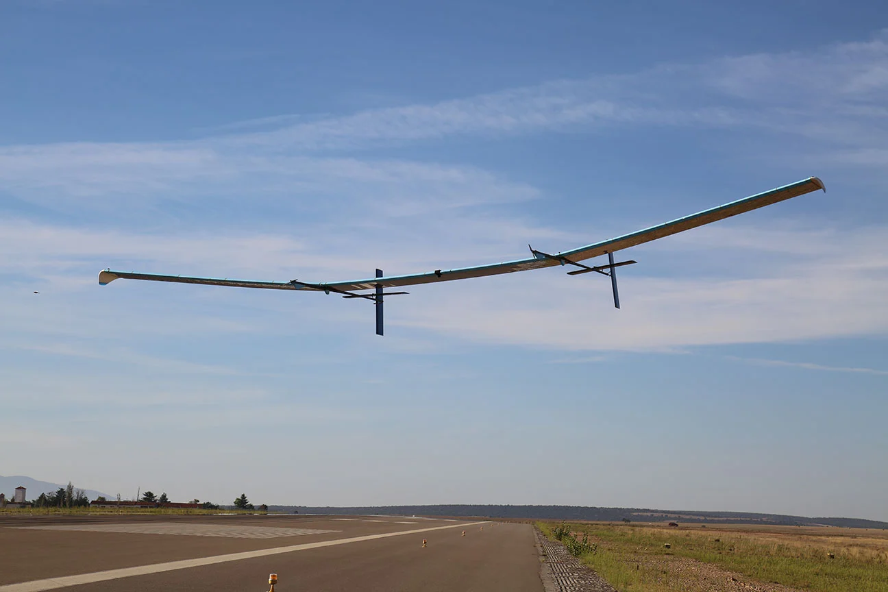
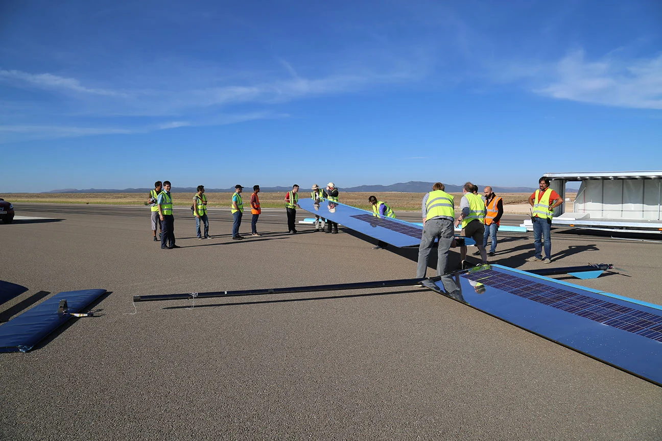
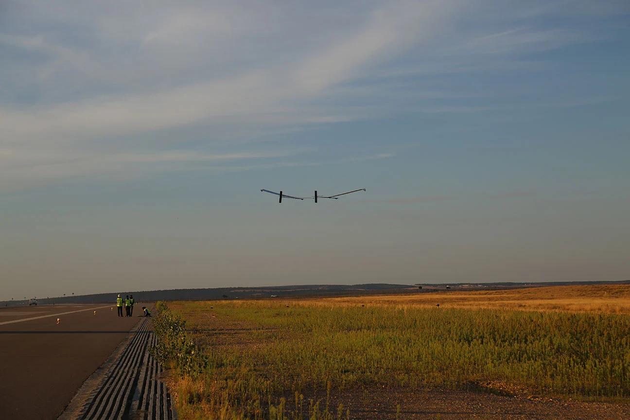
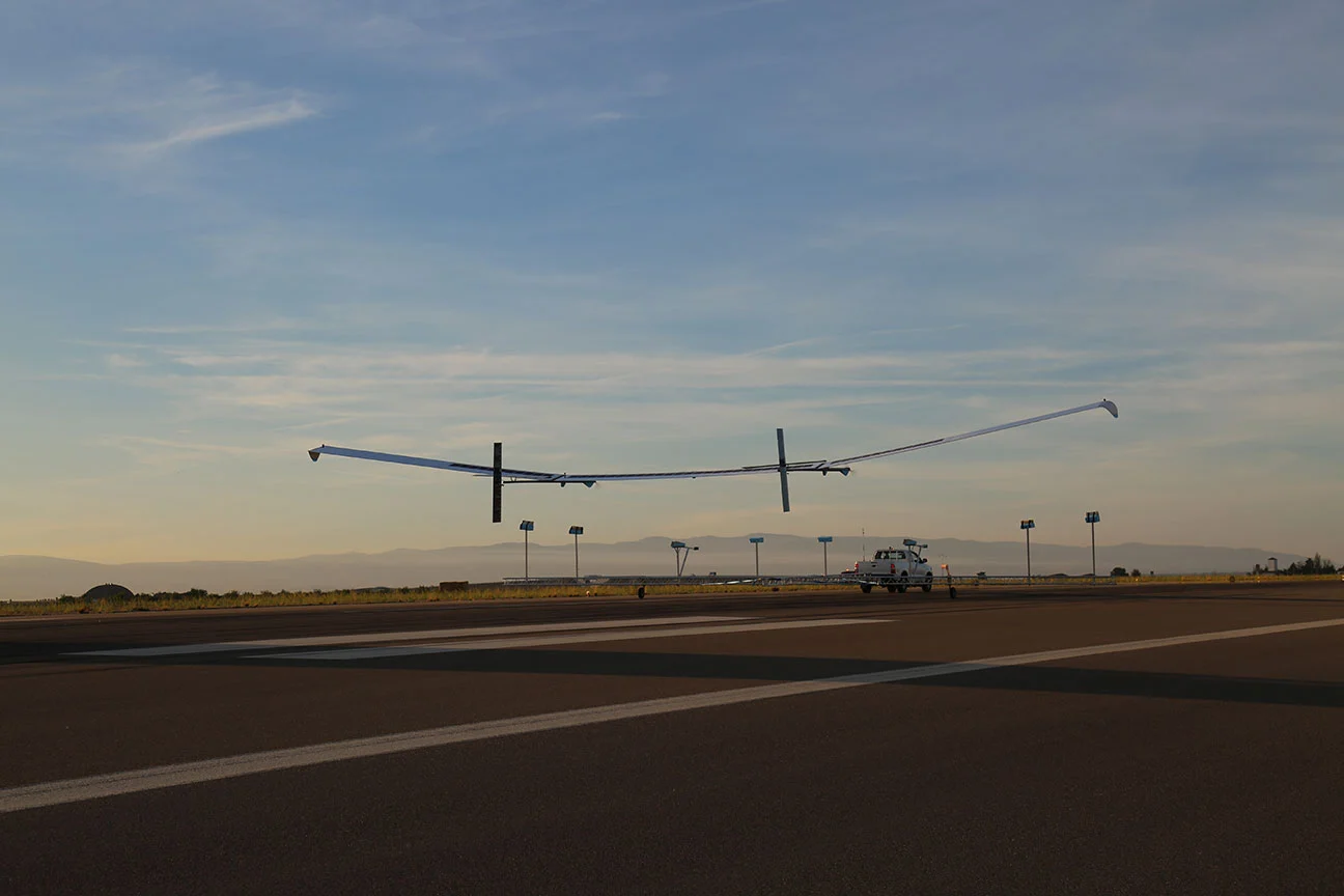
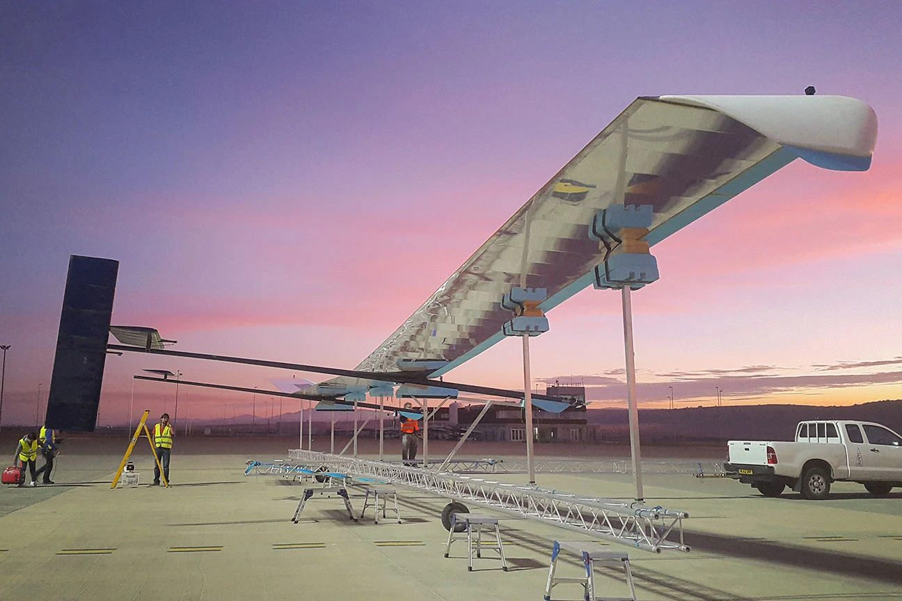
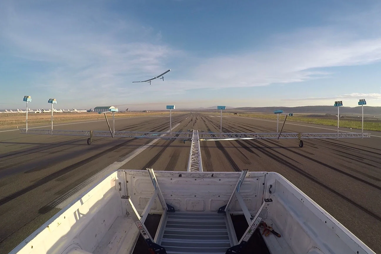
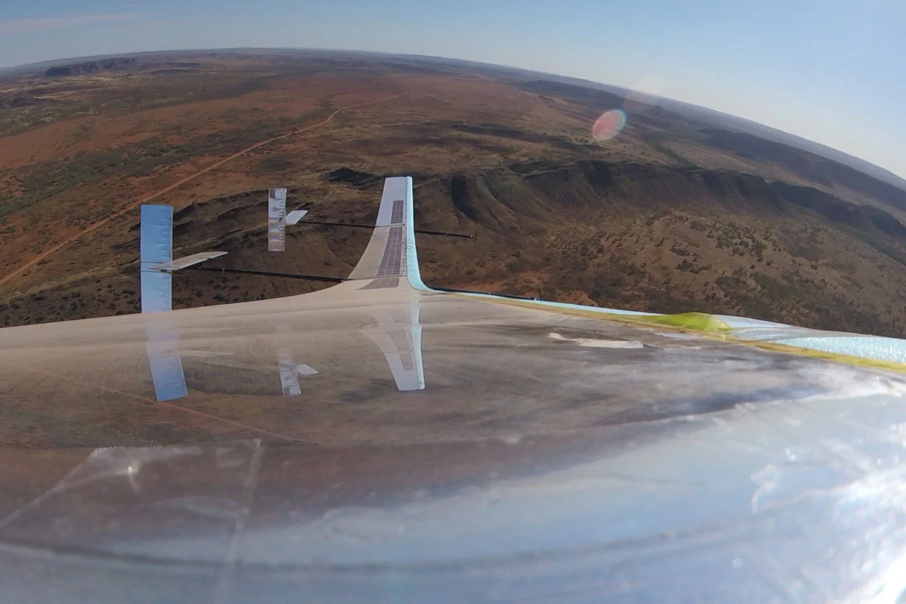
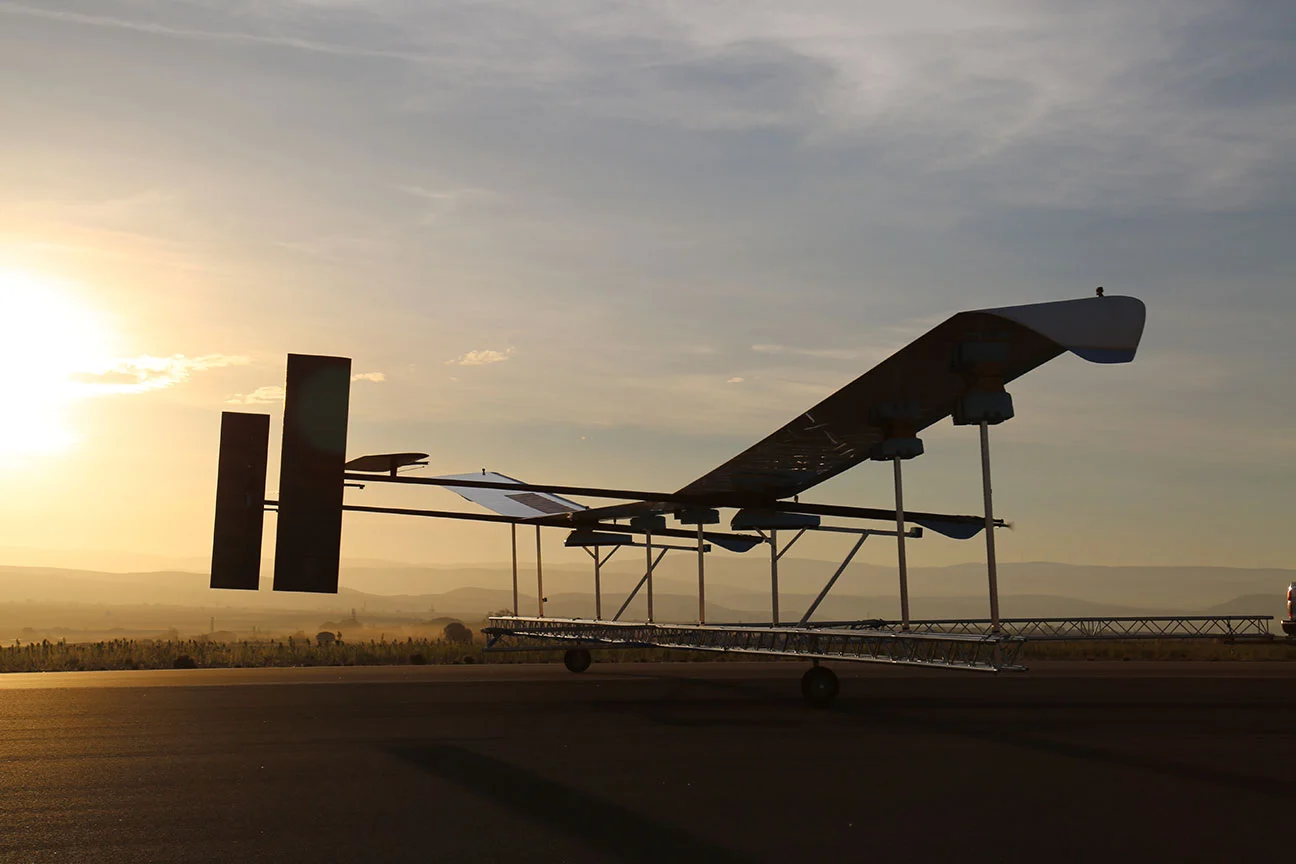
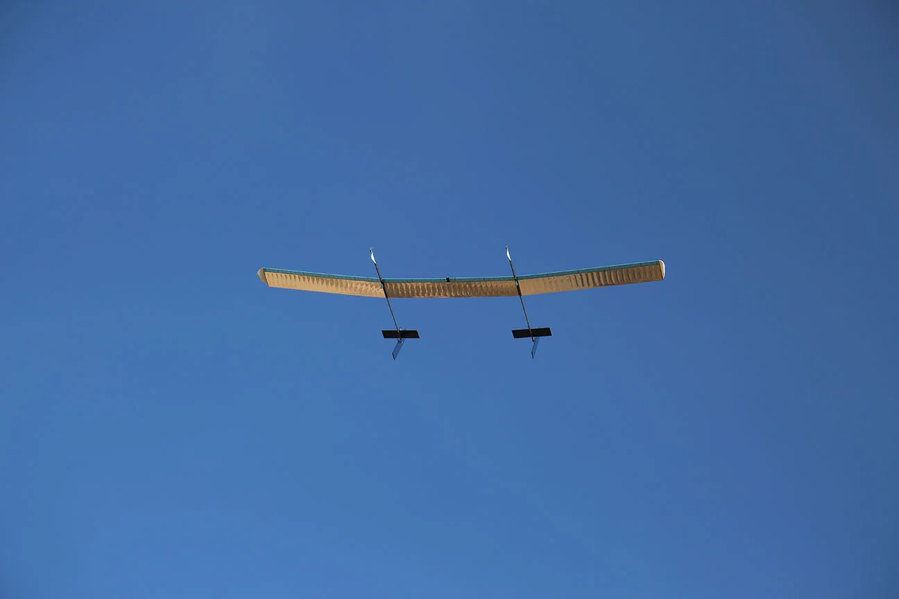
UK-based Astigan Ltd is developing its A3 High Altitude Pseudo Satellite (HAPS) with the goal of giving cartography a boost. The unmanned 149-kg (328-lb) solar-powered aircraft with a wingspan of 38 m (125 ft) is designed to fly at an altitude of 67,000 ft (20,422 m) for up to 90 days as a way to fill the gap between aerial and satellite surveys for more accurate, higher-resolution map making and other applications.
Map making is one of those fields that is as much an art as a science. It requires a keen, disciplined eye for detail combined with the ability to clearly translate information to a two-dimensional surface. It also requires a willingness to embrace all manner of cutting-edge technologies to gather data, process it, and to turn out finished maps in both digital and printed forms.
Some maps, like those for underground trains, only need to convey simple information in a highly stylized form, but others, like topographic maps, must include a staggering number of details with a precision to within a fraction of an inch. The latter is particularly important for not only the weekend rambler, but also for the military, civil engineers, urban planners, archaeologists, and many others.
Additionally, the Earth's surface is constantly changing as forests are cut down or replanted, cities expand, roads are built, and even whole islands grow, shrink, or disappear. Because of this, cartographers must constantly update their maps at surprisingly short intervals to make sure their customers get the most reliable, up-to-date information.
It was for this reason that Britain's mapping service, the Ordnance Survey (OS), established Astigan in 2014. The OS has a reputation for pushing cartography to its limits and was a pioneer in aerial surveying during the First World War. Now it's working to create a HAPS system that combines the constant eye-in-the-sky presence of a satellite with the high resolution capabilities of conventional aircraft.
The idea behind the Astigan A3 is that is will be able to quickly and cheaply cover very large areas of country or to constantly monitor one area for weeks on end. This will allow it to not only help to update existing maps, but also to provide geospatial databases for areas of the developing world that cannot afford conventional surveys, or to monitor transient events like shifts in the ice cap or oil spills – even in real time.
According to the OS, the Astigan A3 has already completed eight full-scale flights in collaboration with British small businesses, industry experts, and universities. It's expected to make its final flight test in 2020, after which it will go fully operational.
"Astigan is another example of OS being at the forefront of geospatial technology," says Neil Ackroyd, a Co-Founding Director of Astigan and Acting CEO of Ordnance Survey. "The platform has been designed to offer major cost and efficiency advantages over traditional methods. The company has produced a unique, British-made platform which can carry a range of interchangeable earth observation instruments such as high-precision cameras, atmospheric monitoring systems and multi-spectral sensors.
"Astigan supports Ordnance Survey in enhancing its capabilities to work in partnership with other nations across the globe. By aligning this capability with our world-class geospatial production and mapping expertise, we hope to support organizations and countries in tackling major societal challenges including urbanization, land management, environmental change and mapping to support emergency response in the case of natural disasters."
The video below discusses the Astigan project.
Source: OS


