Maps
-
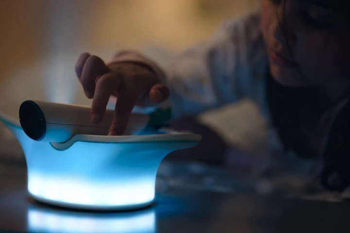 Air travellers have become fairly used to onboard live flight maps, that show how far their plane is from its destination. Canadian airline WestJet is now introducing a device that projects such maps within children's bedrooms, letting them know how soon their parents will be home.
 -
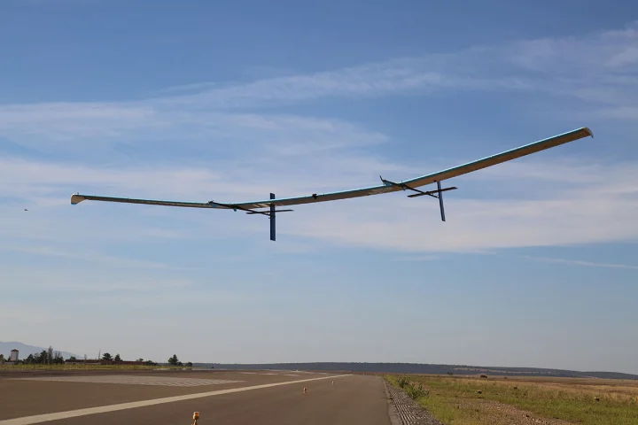 Astigan Ltd is developing its A3 High Altitude Pseudo Satellite (HAPS) with the goal of giving cartography a boost. The unmanned 149-kg (328 lb) solar-powered aircraft is designed to fly at an altitude of 67,000 ft for up to 90 days as a way to fill the gap between aerial and satellite surveys.
 -
 The earliest known map of Australia sold for £248,750 (US$321,819) at a Sotheby's auction in London this week. Dubbed Australia's birth certificate, the map was the first to name Australia as Nova Hollandia (New Holland) and the first to name Novo Zeelandia (New Zealand).
 -
 A team of Philadelphia University freshmen were recently tasked with creating a visual showpiece machine based on a painting which incorporated da Vincian thought processes. They built a cranked machine where sections of a topographical map are slowly raised when the handle is turned.
 -
 Most common world maps are highly size distorted, with anything toward the poles tending to look much bigger than it really is. Which, in some ways, makes this weird-looking projection a lot more accurate. How it's made is a fascinating process – now, what is it actually useful for?
 -
 From the rare scribblings of Alan Turing through to the genius of Newton, Einstein and Émilie du Châtelet, we continue to navigate our way through the fascinating list of the 50 most valuable scientific documents of all-time.
 -
 In the third installment of our series covering the most valuable scientific documents of all-time we encounter works from Aristotle and one of history's greatest female scientists, along with the first "accurate and complete" map of the world.
 -
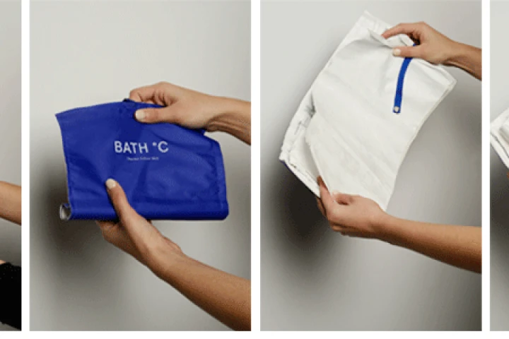 Here's a neat idea from a young designer based in Bath, England. The BATH °C Thermo Colour Map offers a new take on the tourist map by highlighting certain areas of the city that are most suitable to visit, depending on the weather.
 -
 Tactile graphics company Touch Graphics and the University of Buffalo's IDeA Center have collaborated to create multi-sensory 3D maps that give spoken directions and building information when touched, along with sound effects and overhead video projection related to a particular place.
 -
 Sometimes it's preferable to take the scenic route to a destination rather than the shortest. It's not an option available on online maps, but a new concept has shown that it could be. Yahoo researchers have found a way to quantify the beauty of different places and use the data to give directions.
 -
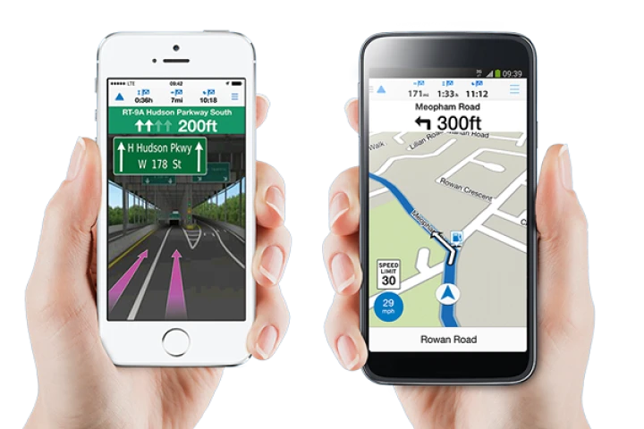 US-based GPS specialists Garmin has announced a navigation application for smartphones. In an attempt to recapture ground lost to Google and Apple Maps, Viago features the basics of a typical navigation app but can also be customized through a number of advanced in-app purchases.
 -
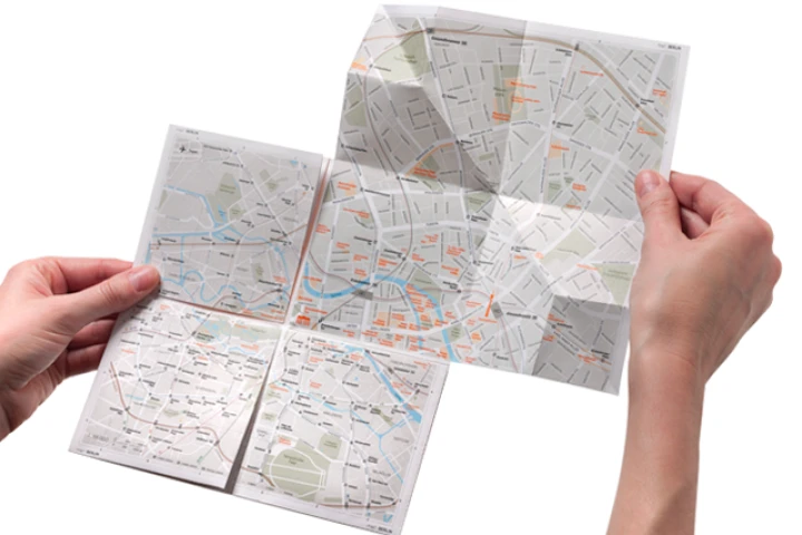 map2 is a paper map that allows users to "zoom in" on sections of the city, through a unique folding system.
Load More