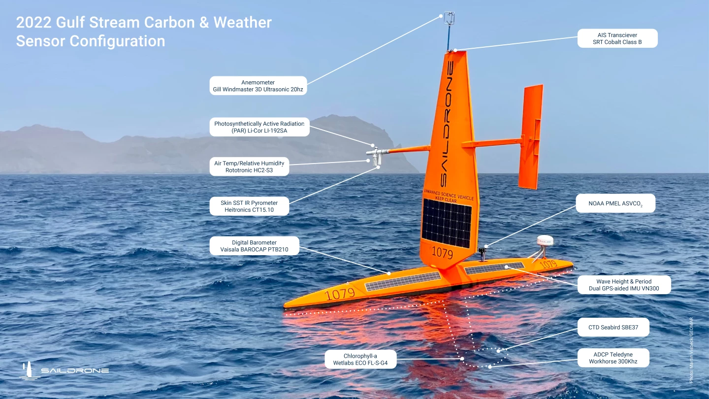
After sending a fleet of self-sailing drones into the path of Hurricane Sam to help improve forecast models, Saildrone has now launched three uncrewed surface vehicles into the Gulf Stream winter to gather data on carbon uptake in the ocean.
"There is a lot of uncertainty in ocean carbon uptake – nearly 4 billion tons of CO2 separates the average of the model-based estimates from observation-based estimates," said project co-lead, Jaime Palter. "That’s nearly as much CO2 as is emitted by the US [about 5 billion tons] each year! With more in situ observations we can do better."
So three Saildrone Explorers have been deployed from Newport, Rhode Island, on a six-month mission led by scientists from the University of Rhode Island (URI) and the European Centre for Medium-Range Weather Forecasts (ECMWF). The Google-funded project will see the drones sail through what's described as North Atlantic's swiftest current and one of the most hostile environments on Earth to collect in-situ data in the region to help reduce uncertainties surrounding how much carbon dioxide the ocean actually absorbs.
The 23-ft-long (7-m) drones are propelled by the wind thanks to a 15-ft (5-m) wing, with the onboard sensors – including an ASVCO2 sensor designed by the National Oceanographic and Atmospheric Administration's Pacific Marine Environmental Laboratory, and Acoustic Doppler Current Profilers – powered by solar panels.

Such craft have already successfully sailed across the Atlantic in both directions, a version wing a special "hurricane wing" has streamed live video from the eye of a category 4 hurricane, and another custom model traveled more than 13,670 miles (22,000 km) in 196 days to become the first autonomous vehicle to circumnavigate Antarctica.
This latest mission will see one Saildrone stationed east of Cape Hatteras, NC, another positioned mid-stream, and a third off the Grand Banks of Newfoundland. The Explorers sail back and forth across the Gulf Stream to collect data for two research projects.
The near-real-time data will be sent via satellite for onward transmission to the URI Graduate School of Oceanography team, which will study how much carbon dioxide can be absorbed and make maps of air-sea carbon exchange across the Gulf Stream. The ECMWF, meanwhile, is hoping to determine the precise location of the Gulf Stream and measure the temperature differences at the boundaries of warm and cold waters.
"The Gulf Stream also has a big impact on weather forecasts and climate predictions," said ECMWF's Philip Browne. "We are excited to be able to target Saildrones to collect data from this physically and scientifically challenging region to help improve our earth system approach to forecasting."
Source: Saildrone


