Drones

MIT's SkyCall system uses a drone to guide people around campus

MIT's SkyCall system uses a drone to guide people around campus
Navigating outdoors on the MIT campus (Photo: MIT SENSEable City Lab)
View 6 Images
MIT's Skycall system has a drone guide students and visitors on campus (Photo: MIT SENSEable City Lab)
1/6
MIT's Skycall system has a drone guide students and visitors on campus (Photo: MIT SENSEable City Lab)
A close showing how you can call a drone (Photo: MIT SENSEable City Lab)
2/6
A close showing how you can call a drone (Photo: MIT SENSEable City Lab)
The quadcopter leads the way once it's given the destination code. (Photo: MIT SENSEable City Lab)
3/6
The quadcopter leads the way once it's given the destination code. (Photo: MIT SENSEable City Lab)
Following the drone around campus (Photo: MIT SENSEable City Lab)
4/6
Following the drone around campus (Photo: MIT SENSEable City Lab)
Navigating outdoors on the MIT campus (Photo: MIT SENSEable City Lab)
5/6
Navigating outdoors on the MIT campus (Photo: MIT SENSEable City Lab)
Following the drone indoors (Photo: MIT SENSEable City Lab)
6/6
Following the drone indoors (Photo: MIT SENSEable City Lab)
View gallery - 6 images

The latest personal tour guide to zoom around the MIT campus flies a few feet off the ground, uses GPS and responds to phone calls. Aptly named Skycall, the drone that functions as a hovering tour guide is the brainchild of MIT’s SENSEable City Lab, which created the system to help students find their way on campus. It lets users summon it through a call, flies to where they are and leads them to their destination at an unhurried pace, while they trail along behind it.

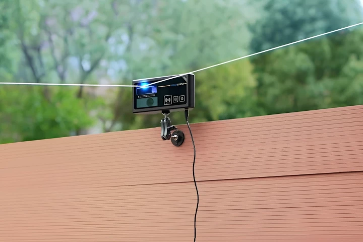
The SENSEable City Lab team came up with Skycall as a solution to help students and visitors navigate what their site calls "one of mankind’s most difficult and disorientating labyrinths" – the MIT campus. The prototype system consists of a drone quadcopter, whose design at the moment is "quite raw" according to Christopher Green, a Research Fellow at the Lab. It's equipped with an onboard autopilot, camera, Wi-Fi, GPS navigation system and sensors that allow it to fly autonomously and determine its location.

When a person gets within range, which the team says "could reach a few miles," they can call up the quadcopter through a SkyCall app on their smartphone. Their GPS coordinates are instantly transmitted to the quadcopter, enabling it to fly to them whereupon it waits for further instructions. Once the user enters an alphanumeric code that corresponds to their destination, the drone starts flying at a sedate pace, hovering a few meters ahead of them.

The onboard Wi-Fi enables the user and the quadcopter to communicate with each other through the app. Users can pause the drone, get it to hover in place, and resume its services when needed. The drone in turn waits in place if it detects the user falling behind and asks them to close the distance. Acting as a personal tour guide, the quadcopter also describes landmarks along the way via the app.

While Skycall might seem a little gimmicky, it's part of the team's overarching goal to find different applications for drones. "Drones have so far had a lot of bad press and rightly so," Carlo Ratti, the lab's director tells Gizmag. "But in fact they can have extremely useful urban applications, especially if their control is put in the hands of people."

Creating drones that can operate in everyday environments and interact with people requires sorting out quite a few challenges. "From developing a stable flight platform to debugging communications there were many non-trivial hurdles," Green tells us. "Sometimes the autonomous UAV would make a break for freedom away from the GPS coordinates we had assigned it. There were many mysteries like this."

Following the drone around campus (Photo: MIT SENSEable City Lab)

While the drone uses sonar sensors to help it avoid obstacles and stay away from walls, it does require user help in certain instances, such as opening a door. Solid solutions to problems like an object flying or colliding with the drone also have to be developed. "Work is ongoing to implement other vision/perception systems in the future, such as onboard LiDAR, in order to develop accurate indoor UAV perception and navigation systems," adds Green.

The team hopes to come up with novel ways in which drones "could be positively and poetically deployed in our cities." Skycall is only the first stage of the project; they hope to use drones as environmental sensors next. A plan to have the drones monitor algae blooms and air quality in the Charles River and relay that information in real time is in the works. "This platform of digitized information-gathering will allow us a deeper and broader understanding of our surrounding environments," says Green.

Taking the project a step further, they aim to create a "digital ecology of UAVs" that integrates seamlessly with natural ecological systems. They're figuring out ways to scale a drone-based environmental sensor platform into an easily deployable support framework for emergency services.

They're also working on an unique design for Expo 2015 that will explore the concept of biodiversity and digital insects within a large site containing man-made pavilions and other structures. "We're interested in utilizing UAVs to reconnect barren man-made landscapes with the natural biodiversity of the site's surroundings," Green tells Gizmag. "Hence the metaphor of digital insects performing analogous tasks to their natural counterparts – swarming over the Expo site to actually sense and identify potential locations and fertile soils, whereby they can actually pollinate and repopulate nature – planting seeds and even deploying real insects."

"This poetic possibility is a vehicle for speculating on how technology comes full circle to allow a man-made system to reconnect to the natural world," adds Yaniv Jacob Turgeman, the Research Head at the lab.

Check out a video of Skycall below.

Source: MIT via Dezeen

SKYCALL

View gallery - 6 images
8 comments
8 comments
Simon Sammut
OMG.. that is so sci fi sweet!!! that's not JUST gimmiky.. if you really were lost that would be a life saver!!
Rokdun Johnson
This video is awesome. Impressive technology, funny story and great images.
Pecos Pete
Just an excuse to spy on you!
Joe Goebel
Neat tech, interesting idea, plenty of hollywood - I mean, have you ever heard how loud 4 electric motors with propellers are?
I'm a big fan of UAVs. endless applications to make life better for humans and the planet. BUT, when do we start to put a value on human interaction? And is reading a map really that hard that having dozens of UAVs flying around college campuses to help users find their way a reality? Doubt it. If i want to impress my visitors, a human with a modicum of personality, a little wit and a decent understanding of the university, its history and culture will ALWAYS be better than any drone, or robot for that matter. At some point we have to see that its the imperfections, the beauty of flawed, fallible humans that makes them so special, and valuable. Can you imagine how ugly a forest would be if every tree was "perfect," a carbon copy of the one next to it? Forget about the various technical and safety issues of a swarm of drones buzzing about - does MIT really want to reduce its visitor experience to a robotic voice and an exceptional navigating airborne lawn mower? I think not....... The future is full of drones and UAVs, doing very important work, but I'm not betting on this one.
warren52nz
I thought it was very entertaining. I imagine there are many better ways to get you to a location from an efficiency and perhaps safety perspective but it still made me laugh and we shouldn't play down the importance of entertainment. On the other hand if you're in a learning institution shouldn't being able to find your way around be just another test of your abilities?
Nathaneal Blemings
This is awesome, really great. Its good to see people pushing to actually use these drones in novel ways in our day to day lives. Ok maby its not in our day to day lives just yet, but people have to pioneer using these drones in unique ways in order for the rest of the population to catch on.
Im not sure what they plan to do about people stealing the drones. Would be a problem if they kept sending drones out, but they never come back. I think there should be a way you have to login and have some sort of credentials, someway to vet you.
It seems to work very good, even inside, a school this size could afford to invest in the number of drones that would be necessary for this to work effectively.
Stein-Erik Dahle
I love drones, I'm even playing around with a few of my own, but this seems like an overkill if I may say so.
The smartphone can be a very usefull guide in itself, with its exstensive array of sensors and apps, including GPS-guided navigation systems.
Les LaZar
I develop multi-rotor vehicles such as this and I think this is a killer app. Literally... Operating what is essentially a flying lawnmower at eye-level in an environment with random, uninvolved people is asking for nasty injury, even with sonar collision avoidance.
Even if the rotors were shielded, the practical run time for a quad this size is only 15-20 minutes. In this time, it needs to get from its parking place to the user, show the user the path and return to its charging station.
An interesting concept, but not very practical at this time.