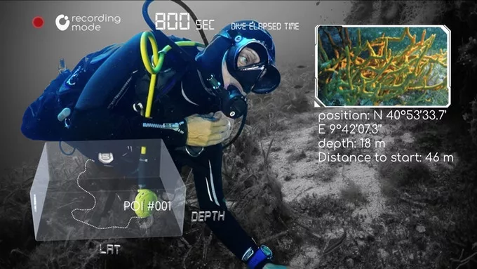
Although many scuba divers utilize wearable computers to track dive stats, those devices can't record an actual map of the underwater route that the user travelled. The newly-developed Brizo, however, is claimed to do exactly that.
Named after an ancient Greek goddess who protected mariners, Brizo was created by Italian startup Oengineering.
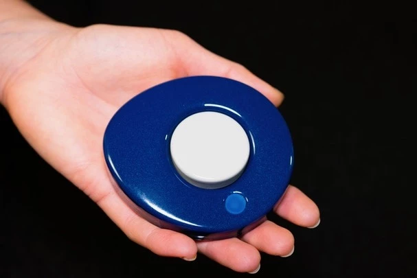
Utilizing mounting-strap slots in its body, the user attaches the gadget to their existing BCD (buoyancy control device). Upon reaching the put-in site for their dive, they then power Brizo up by giving a long press to its single central control button. This causes an integrated GPS module to record the coordinates of that location, on a built-in microprocessor.
Because GPS doesn't work underwater, though, Brizo switches over to using its IMU (inertial measurement unit) once it detects that the diver has entered the water. That IMU utilizes its accelerometer, magnetometer and gyroscope to ascertain the user's speed, heading and orientation. Additionally, a water pressure sensor is used to determine the current depth.
Other sensors track water temperature and conductivity, the latter of which can be used to calculate pH levels. And whenever the wearer sees something interesting, they're able to tag its location by tapping the control button.

All of this data is continuously recorded on the device throughout the dive, after which it's transferred via Bluetooth to an app on the user's smartphone or computer. Utilizing that app, they can then see a time- and date-stamped three-dimensional map of the dive. If they took photos or videos of the items of interest, those can be linked to their tagged locations on that map.
What's more, if users make their data publicly-accessible via the cloud, oceanographers and other scientists can use it to aid in their research.

Brizo is compatible with iOS and Android mobile devices, along with Windows and Mac computers. One charge of its battery is claimed to be good for about two days of use, at a rate of three dives per day. The device works down to a depth of 60 meters (197 ft), although an upgrade doubles that figure, potentially allowing for its use on unmanned submersibles.
Should you be interested, Brizo is currently the subject of a Kickstarter campaign. A pledge of €290 (about US$323) will get you one, when and if they reach production. The planned retail price is €600 ($667).
Sources: Kickstarter, Brizo


