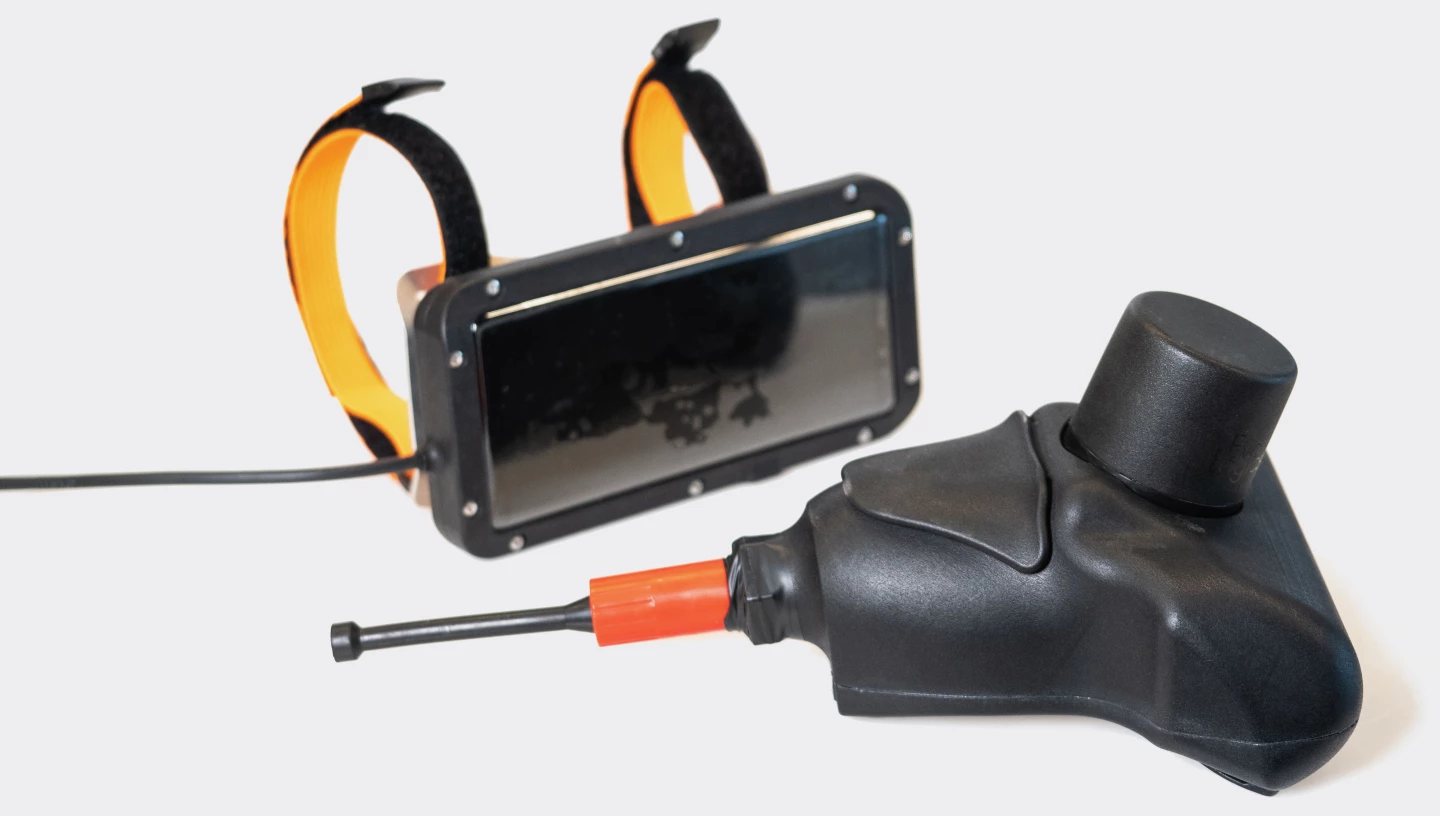
Because GPS doesn't work underwater, divers usually can't track their real-time position on a digital map. The new Diver Navigation System (DNS) gets around that problem, however, using both floating and wearable acoustic transponders.
Manufactured by German underwater tech company EvoLogics, DNS consists of three main components: a tracker unit, a diver console, and a USBL (ultra-short baseline) buoy.
Floating at the surface over the diving area, the buoy continuously sends acoustic "pings" through the water. These are received by the tracker unit, which is mounted on the diver's air tank. The tracker automatically responds to each initial ping with a reply ping of its own, which is received by the buoy.

By analyzing the amount of time that elapses between each initial ping being sent and its reply ping being received – and the direction from which the reply came – it's possible to determine the diver's present position relative to the buoy.
And because the buoy does have GPS access (via a GNSS module), its location on a map of the area can be determined by an integrated microcomputer. Therefore, the diver's current location on that map can also be established.
This data is sent back down to the tracker unit in subsequent pings. It's relayed from that device to the hard-wired diver console, which is a smartphone-sized gadget worn on the wrist. Simply by glancing at the console's screen, the diver can see where they are on the map at all times.
They can also check the locations of other divers in their group, as the buoy can communicate with up to five trackers at a time. The buoy additionally uses an onboard Wi-Fi transceiver to relay its data to a topside support crew, who can track the locations of all the divers on a laptop or tablet.

As an added bonus, the console also lets divers send and receive simple preprogrammed text messages to and from one another – again, the data is transmitted via acoustic pulses. The topside crew can also send and receive such messages via the Wi-Fi-linked buoy.
As far as hard numbers go, the system has an underwater communications range of 1.5 km (0.9 miles), a positional accuracy of plus or minus 10 cm (3.9 in), and a claimed battery runtime of up to eight hours. The tracker and console have a maximum depth rating of 50 m (164 ft).
You can see the DNS in use, in the video below.
Source: EvoLogics


