The mystery of flight MAF370, which vanished over the Indian Ocean with all hands, has baffled the world for nine years, but now a geoscientist at the University of South Florida may have found a surprising way to locate the wreck using barnacles.
On March 8, 2014, Malaysia Airlines Flight 370 took off from Kuala Lumpur for Beijing. About 38 minutes later, the Boeing 777-200ER with its 227 passengers and 12 crew made its last radio communication as it flew over the South China Sea.
Minutes later, the aircraft vanished from air traffic control radar and Malaysian military radar tracked it for another hour as it deviated from its planned course and headed west over the Malay Peninsula and the Andaman Sea before getting out of range. Later data from the Inmarsat satellite indicated that it was flying southwestward over the Indian Ocean.
Exactly what happened to MAF370 remains a mystery to this day. The Australian Transport Safety Bureau (ATSB) concluded that some malfunction caused the plane's complement to succumb to hypoxia, but lack of firm evidence resulted in a remarkable raft of imaginative hypotheses as to its fate.
These ideas included a terrorist attack, hijacking by North Korea, an assassination attack aimed at one of the passengers, a secret diversion to the US air base on Diego Garcia, one of the crew committing suicide, a deliberate or accidental shoot down, a cyberattack, and the fringy claims about meteors, black holes, and alien abductions.
The answers might be found if the airliner could be located in the 28.3 million mi² (72.4 million km²) of the Indian Ocean, but an extensive four-year search with sonar, submersibles, drift models, and other high-tech methods have failed to turn anything up.
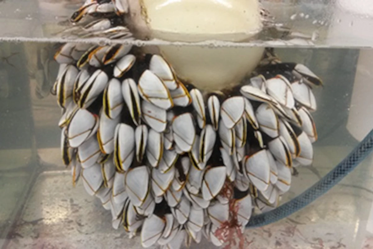
Now, Gregory Herbert, an associate professor in the School of Geosciences at USF has proposed a new search method based on barnacles. About a year after the crash, debris from MAF370, including a flaperon, washed up on the shores of Réunion Island off the coast of Africa. What was especially interesting is that the flaperon was home to a colony of several generations of stalked barnacles called Lepas anatifera.
According to Herbert, these barnacles add layers to their shells on a daily basis and the ratio of oxygen isotopes absorbed by the shell varies with the surface temperature of the water that the debris was floating in. In addition, some of the barnacles were so large that they might have colonized the debris shortly after the crash.
By measuring the isotope levels of barnacles grown in the laboratory under controlled conditions, Herbert and his team were able to combine the water temperature measurements recorded in the shell layers and apply them to oceanographic modeling to create partial drift profiles.
In other words, the large surface water temperature variations found in the Indian Ocean along the probable course of MAF370 and recorded in the shells allowed the team and oceanographers at the University of Galway to potentially backtrack the drift of the debris to its source.
Because the largest barnacles were not available for study, the crash site is still unknown, but the new method may at least help to narrow any future searches to a more practical area.
"Knowing the tragic story behind the mystery motivated everyone involved in this project to get the data and have this work published," said Nasser Al-Qattan, a USF geochemistry doctoral graduate who helped analyze the barnacles. "The plane disappeared more than nine years ago, and we all worked aiming to introduce a new approach to help resume the search, suspended in January 2017, which might help bring some closure to the tens of families of those on the missing plane."
The research was published in AGU Advances.
Source: University of South Florida


