
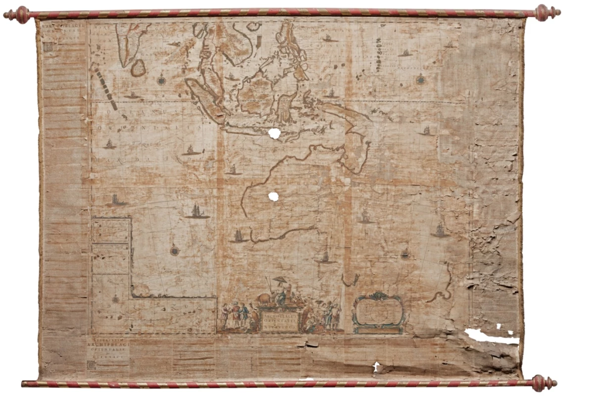
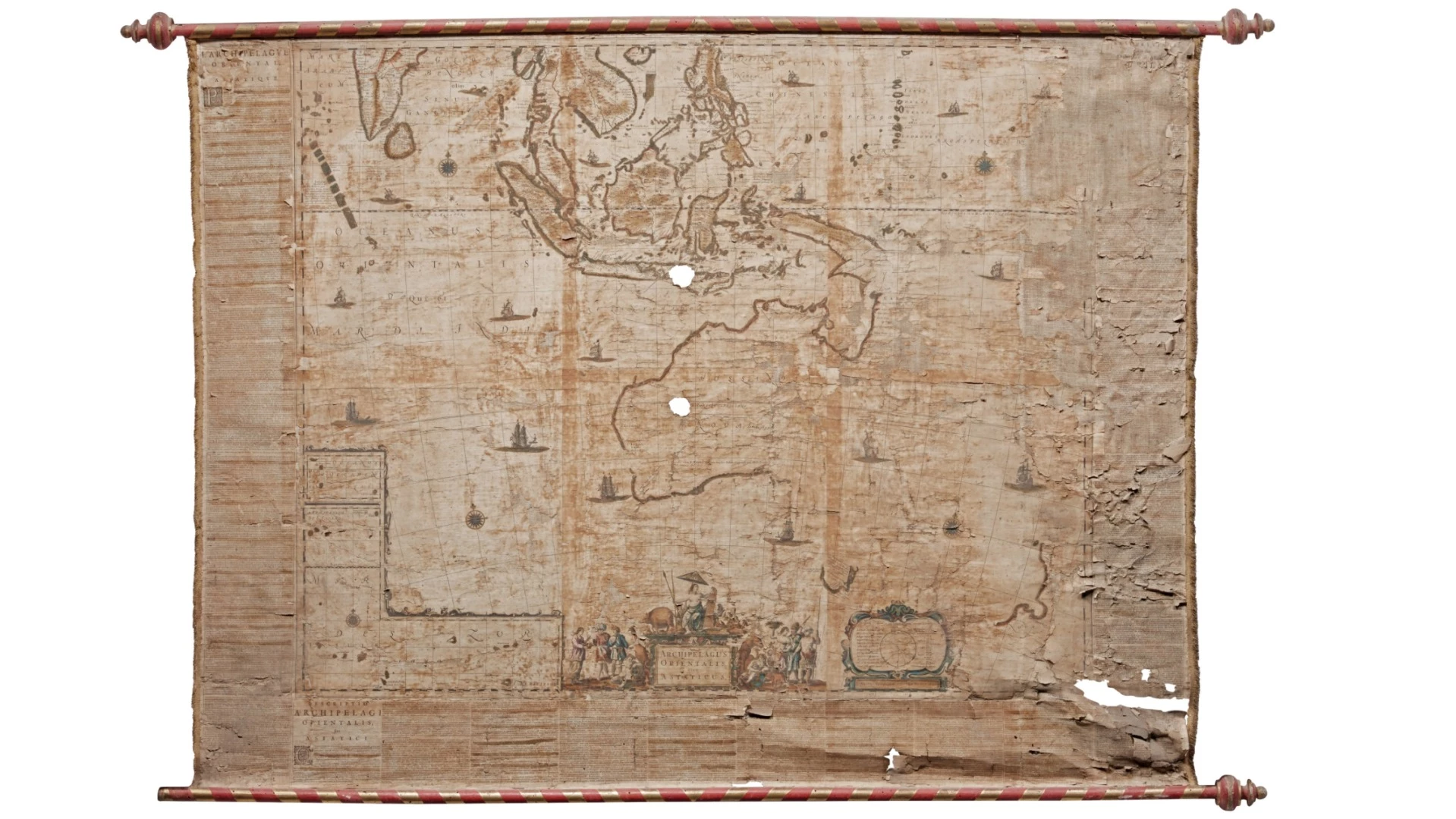
The earliest known map of Australia and New Zealand, Joan Blaeu's Archipelagi Orientalis Sive Asiaticus (1659) sold for £248,750 (US$321,819) at a Sotheby's auction in London this week.
Referred to as "Australia's birth certificate" by the National Library of Australia during its recent Mapping Our World exhibition, the map was the first to name Australia as Nova Hollandia (New Holland) and the first to name Novo Zeelandia (New Zealand).
Though only four copies of Joan Blaeu's map are known to exist, the map that sold at Sotheby's on May 9, 2017 was created even earlier than the copy held by Australia's National Library (1663), having been created in 1659.
The 1.17 m x 1.59 m (46 in x 62 in) Archipelagi Orientalis was one of two original and unrestored maps by Joan Blaeu discovered in an Italian home.
The father and son master cartographers Willem (c.1570-1638) and Joan Blaeu (1596-1673) have appeared many times in our pages for their maps, atlases and globes, most notably in our series of the 50 most valuable scientific documents of all-time, and the 50 most valuable scientific documents of 2016.
The Bleau's remarkable and world-leading knowledge of global geography at this time was primarily due to them being the official cartographers of the massive VOC (The United Dutch East india Company), the world's first multi-national company.
In this article by the Western Australian Museum on the spice trade in Asia, the VOC is described thus: "By the mid-1600s, the VOC boasted some 150 merchant ships and 50,000 employees, a private army of 10,000 soldiers and trading posts from the Persian Gulf to Japan. It was, in effect, a 'state outside the state' with the power to wage war, make treaties with Asian rulers, punish and execute criminals, create new colonies and strike its own coins."
So powerful was the Dutch East India company, that most of the early documented exploration of Australia was simply a by-product of the company's quest for new supplies of spices.
Dutch East India Company captain Willem Janszoon made the first documented European landing in Australia in 1606 in the ship Duyfken, and other famous "explorers" credited with charting what is now Australia, such as Abel Tasman and Dirk Hartog, were also employees of the Dutch East India Company.
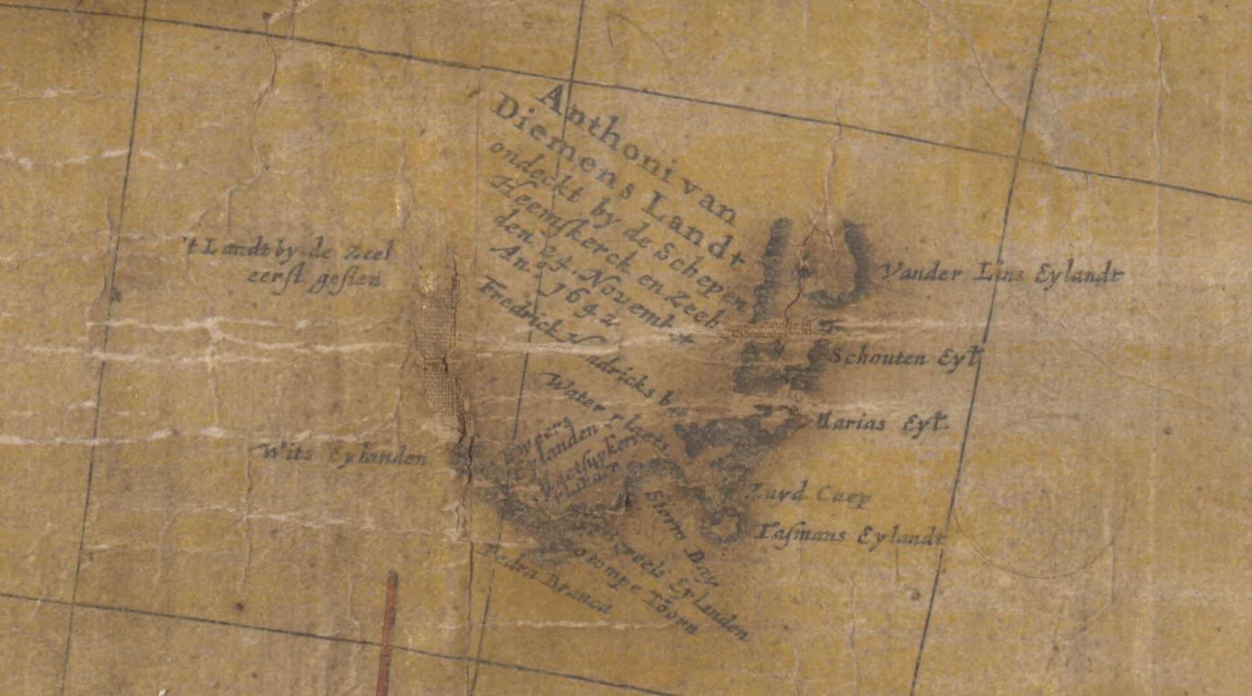
On November 24, 1642, Abel Tasman made the first recorded sighting of the Australian island state of Tasmania aboard the Zeehaen. He named Tasmania Anthoonij van Diemenslandt (Van Diemen's Land), after the head of the Dutch East India Company, Anthony van Diemen. The island was renamed Tasmania after Tasman two centuries later.
Many more place names in Australia have direct links to the Dutch East India Company. The Gulf of Carpentaria in northern Australia is named after Pieter de Carpentier, who like van Diemen, was an administrator of the Dutch East India Company.
As official cartographers of the Dutch East India Company, the Bleau's hence had complete access to the closely guarded intellectual properties of the most powerful company in the world: maps, charts, reports and ships logs and hence the knowledge to create maps such as Archipelagi Orientalis.
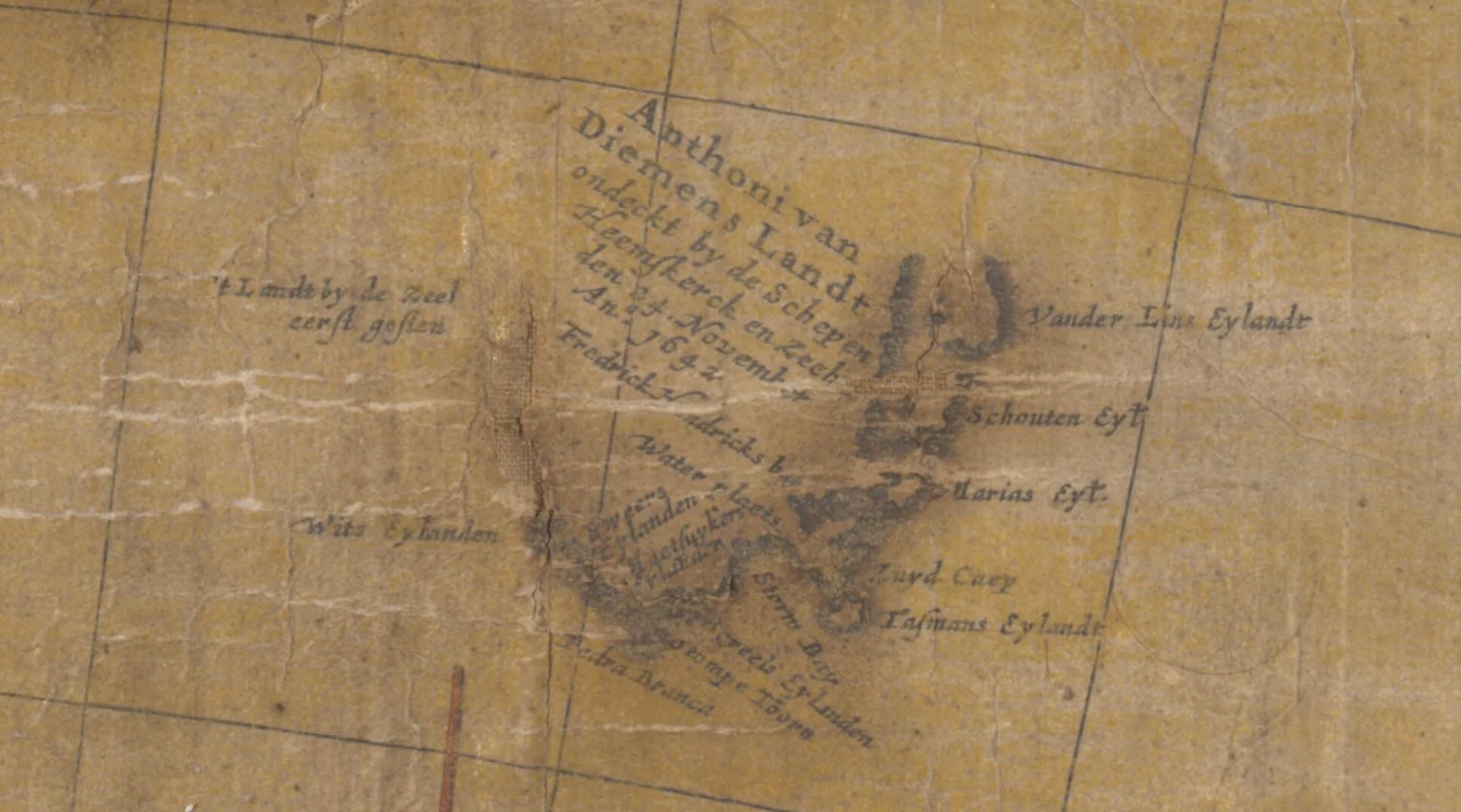
Indeed, Archipelagi Orientalis includes the first details of Tasman's sighting of Tasmania and the first map of the island's coastline. The above image is from the National Library of Australia's 1663 copy of the map and can be explored in detail through the library's on-line imaging system.
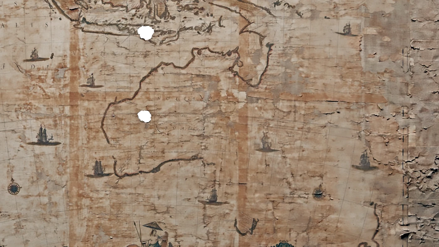
The holed and damaged nature of the Sotheby's copy of Archipelagi Orientalis highlights the many issues faced by those who seek to safeguard our heritage. The above video delves further into the issues encountered by the National Library of Australia in preserving it's 1663 copy of the map.
More information: Sotheby's


