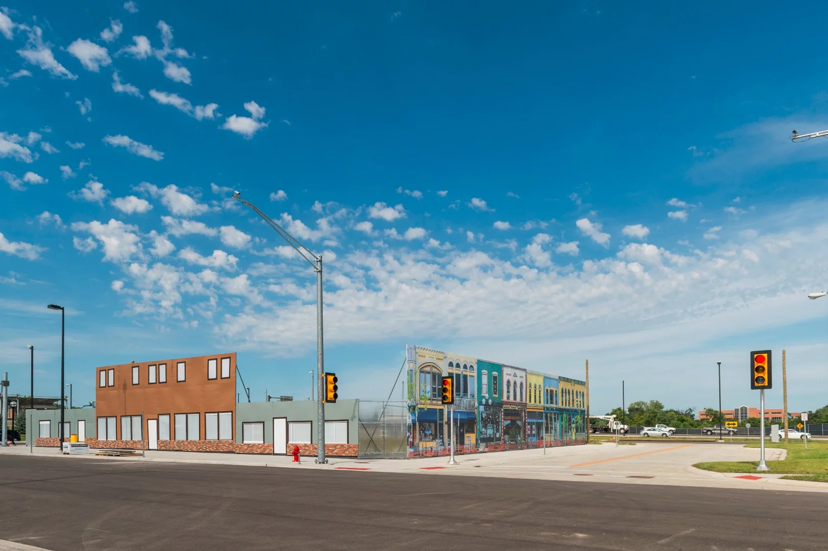


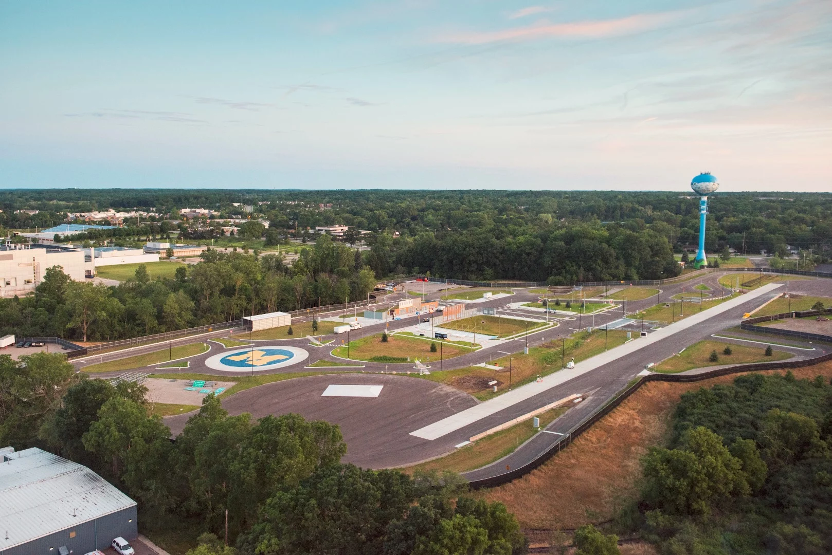
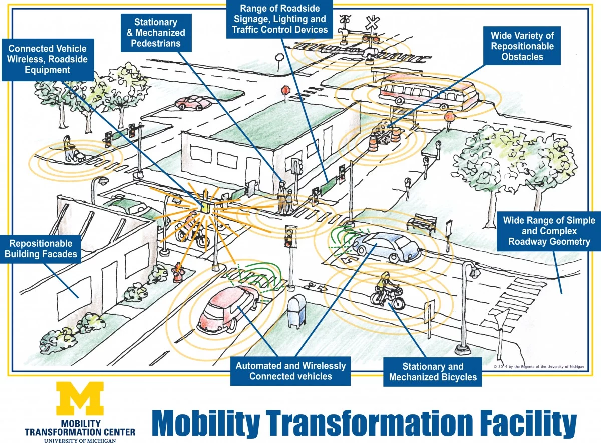
Mcity at the University of Michigan is defined by over 28 acres (11 hectares) of fake buildings, purposefully defaced road signs, and pedestrians pointedly standing in roadways. While this could tax any human driver, the Mcity simulation is designed to test the university's fleet of connected and autonomous vehicles as they interact with an everchanging research facility that's the first of its kind.
Opened yesterday, July 20, Mcity allows researchers to test new technologies, such as its recent 3D-printed autonomous car, in a dedicated but controlled environment before pushing out vehicles to the streets of Ann Arbor or beyond. Unlike public streets, Mcity's movable building facades, changeable traffic signal networks, and full control over things such as lane width allows a fully flexible sandbox.
Some other features that have been built into the "city's" 5 miles (8 km) of lanes include a 1,000-ft (304-m) road that's located precisely north/south to test GPS, a simulated downtown area with blind corners, and realistic materials that include old signs and graffitied materials.
Everything that a car may encounter has been included: 120 road signs (how many could you actually name?), numerous road materials, pedestrians, bikes, roundabouts, tunnels, freeway entrances, rural train crossings, and the universal constant, construction.

It's hard to look at the cartoony flat buildings and not think of an amusement park, but Mcity represents part of a plan to roll out autonomous vehicles from its controlled boundaries to the (real) city by 2021. Partners representing all stakeholders in a connected road landscape were involved, including car manufacturers, lawmakers, data management hardware and software companies, telecommunication firms, and even the companies that make traffic signaling technology.
While data from Google suggests that accidents with autonomous cars generally are the fault of (the other) human driver, there are other reasons why researchers may want a custom playground for these vehicles.
A fully connected and autonomous vehicle landscape relies on wireless communication not only among all the cars on the road, but also from vehicles to the infrastructure such as traffic control systems, and information from pedestrians, via mobile phones. This currently doesn't exist in the average city as such, yet in Mcity it can.
In the video below, the director of the program provides an introduction while you tour parts of Mcity.
Source: University of Michigan, Mobility Transformation Center