When an architect is designing a building, they build a scale model to check how their design will work as an actual physical structure. What happens, however, when engineers are designing things that will have to be compatible with the currents in rivers ... things like dams, bridges, or pump stations? Well, that’s where water resources engineering firms like Northwest Hydraulic Consultants (NHC) come into the picture. Their work often includes building exact miniature recreations of waterways, complete with flowing water. We recently caught up with NHC principal Darren Shepherd, who guided us through the production process of one of his more exciting models – a one-twelfth scale Norwegian whitewater kayaking park.
Shepherd is based out of the firm’s head office in Edmonton, Canada. He works with clients from all over the world, who want to know how their particular project will work with the river (or other body of water) that it’s planned for. They’re curious about factors such as the optimum location for their installation, its ability to stand up to different flow conditions, and its effect on existing structures, facilities or river reaches situated nearby.
Not long ago, NHC was approached by a whitewater paddling club based out of Kongsberg, Norway. The River Numedalslaagen runs through their town, and while it certainly contains rapids, they’re not particularly “playable.” One major ledge, in fact, is downright dangerous – novice paddlers could get trapped and drown in the recirculating hydraulic feature created by it.
Using funding from DNB, which is Norway's largest bank and financial service provider, the Kongsberg Padleklubb wanted to find out how the riverbed could be altered, in order to turn that ledge into a recreational whitewater feature – with the ultimate goal of creating a competition-level playwave under certain flow conditions.

It’s the sort of thing that people might think computers could now be used for, and while digital models are indeed of some use, Shepherd maintains that they’re not good enough on their own. “The advantage of the physical model is to be able to visualize and qualitatively observe the playwave features,” he told us. “Are you getting a nice curl, are the shoulders crashing in? Typically, computer models are a steady-state model, whereas with these [type of] features, things can be unsteady and relatively dynamic ... If you were to try to get to that level of detail with a computer model, it would be excessively large, and the run times would be a number of days.”
Shepherd started the project by traveling to Kongsberg, where he determined the relevant stretch of river to be surveyed, observed its hydraulic features, and participated in numerous meetings with the project team, regulatory agencies and other stakeholders. Using something known as a robotic total station – a surveying instrument comprised of a stationary device that uses a laser to track the precise positioning of a prism mounted on the end of a hand-held survey rod – the paddling club and local Norwegian surveyors were able to create a digital representation of the underwater topography of the riverbed. In areas where the river was too fast or deep to wade, the survey crew utilized a rubber raft held in position on the river by ropes and pulleys secured to both riverbanks.
Armed with all this information, Darren headed back to Edmonton, where he proceeded to create a computer rendering of what the physical model would look like. Knowing how much of the river to include in such models can be tricky, however. In this particular case, the engineers had to make sure that there was enough of a stretch before the ledge in order to properly simulate the flow patterns and distribution of flow across the river, while they also had to include enough river after the ledge to ensure that the water was able to flow off of it unconstrained by the end of the run.

The scale of the model was another consideration. Too large, and the pumping rates required to simulate the full range of river discharges would simply be impractical. Too small, and the unscalable molecular composition of the water would become a factor. After all, while the geographical features of a river can be miniaturized, the physical qualities of water (such as its viscosity and surface tension) can't be made "smaller." In this particular project, the size of the air bubbles within the rapids also had to be accounted for – although the model was one-twelfth the size of the actual section of river, the bubbles in its whitewater sections couldn't be made one-twelfth the size of the bubbles in the river.
Once the paddling club members had approved the rendering, construction on the physical model began.

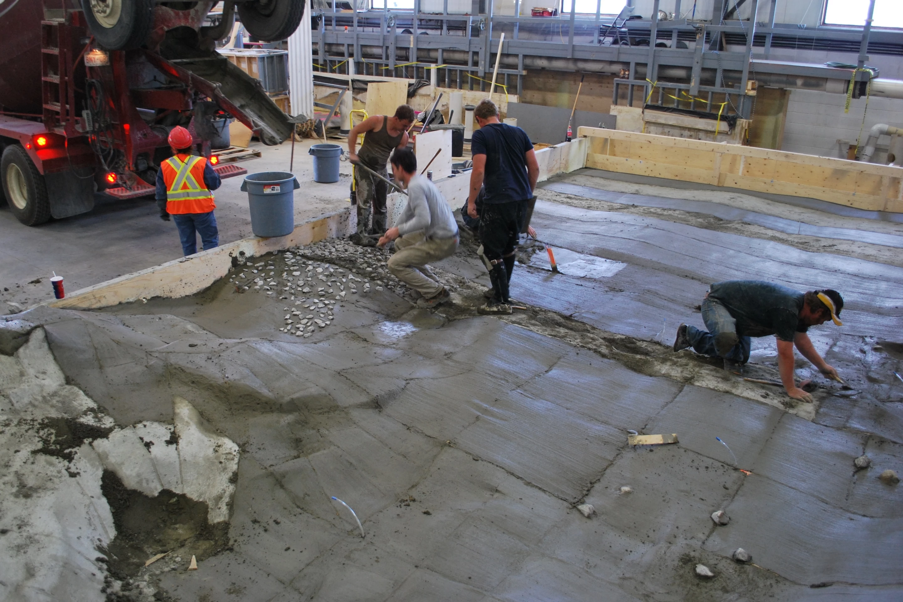
As with most of NHC’s models, this consisted of first building a plywood frame, made up of a series of cross-sectional templates. The upper edges of these templates matched the contours of the riverbed. After the joints in the plywood sheathing were waterproofed with silicone and foam, the model basin was filled with gravel. At this point, pressure taps were also added, which would allow the engineers to precisely measure the water levels at various points in the model. Finally, because the Numedalslaagen River has a hard bedrock bottom, a cap of concrete was added to represent it.
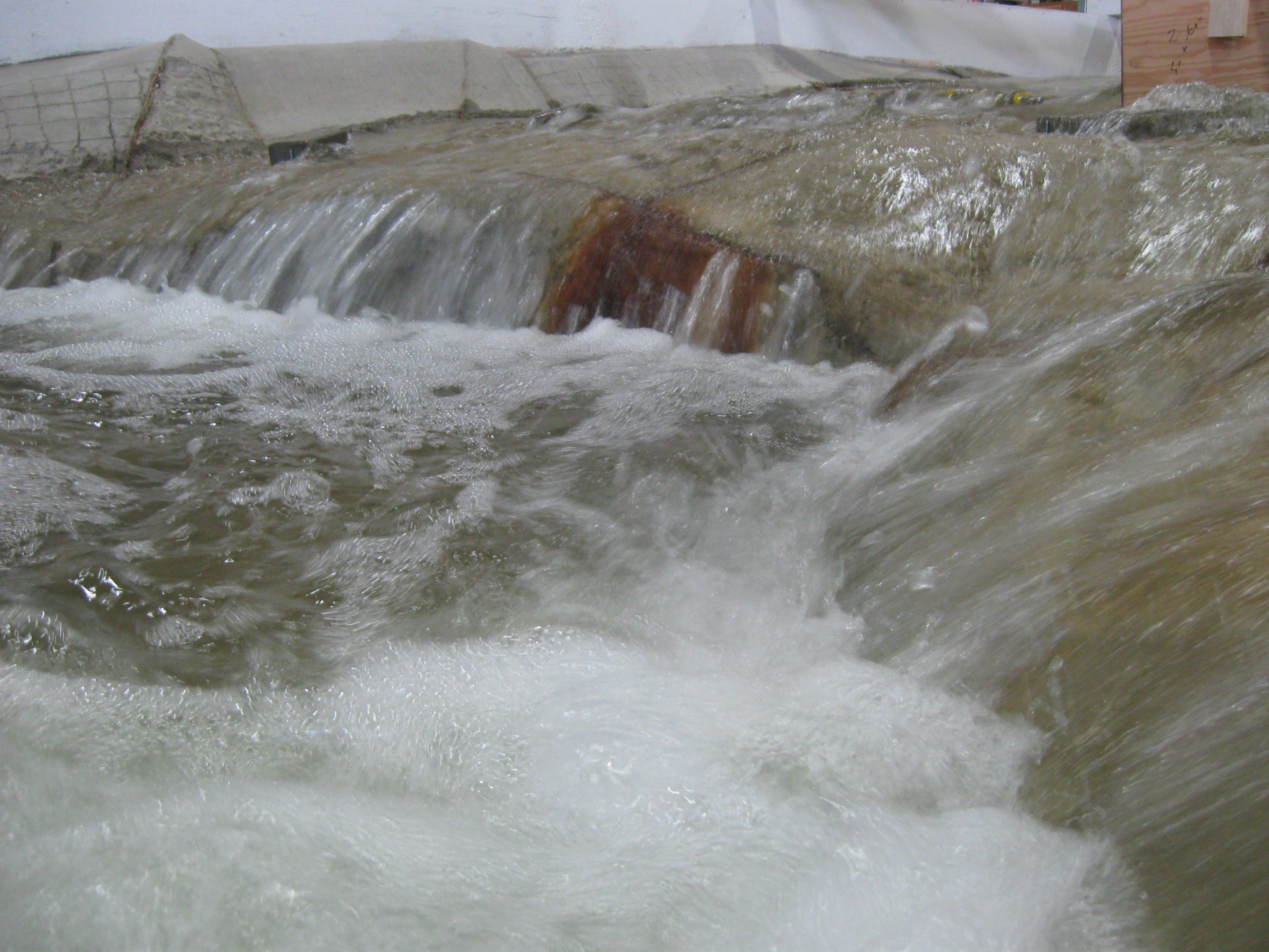
Water was then introduced, and the model’s powerful pumps were turned on to enable its water circulation system. Although the flow rate of that water was essentially just a scaled-down version of the flow rate of the actual river, Shepherd and his team also fine-tuned it by comparing photos and video of features on the river with the same features on their model. As you can see below, they ended up with a very close match.

Once everything was up and running, the engineers set about swapping out the section of the model that represented the ledge (which was designed to be removable) with pieces of material that represented changes that could be made to the bedrock in that area. They even built a one-twelfth scale foam kayak and kayaker, which they used to gauge how usable the resulting hydraulic features were.

After approximately three weeks of testing, NHC delivered a final report to the Kongsberg Padleklubb. The Kongsberg city council is currently reviewing the recommendations outlined within it. If the plan is approved, a local construction firm will be hired to temporarily divert the river, then alter the exposed ledge to Shepherd’s specifications. Darren himself will be on site during the construction process, acting as a consultant.
The elaborate model, which took a little under four weeks to construct, has already been dismantled. A model for another client, however, is already on its way in – posing its own unique challenges and rewards.
“In the end, it’s nice to see that you’ve created something that’s going to benefit a community,” said Shepherd. “And as many of my clients say, ‘You get to be a kid in your job, you’re playing in the sandbox all day.’”


