Space

NOAA releases first impressive photos from next-gen satellite

NOAA releases first impressive photos from next-gen satellite
Composite image of Earth's full disk as captured by GOES-16's Advanced Baseline Imager Instrument at 1:07 p.m. EDT on Jan. 15. 2017
Composite image of Earth's full disk as captured by GOES-16's Advanced Baseline Imager Instrument at 1:07 p.m. EDT on Jan. 15. 2017
View 11 Images
Comparison of the capabilities of the GOES-16 satellite compared to the older GOES-13 probe. Both images of Earth's disk were captured on Jan. 15. 2017
1/11
Comparison of the capabilities of the GOES-16 satellite compared to the older GOES-13 probe. Both images of Earth's disk were captured on Jan. 15. 2017
GOES-16 image captured on Jan. 15. 2017 showing the west coast of the United States and the Baja Peninsula in Mexico
2/11
GOES-16 image captured on Jan. 15. 2017 showing the west coast of the United States and the Baja Peninsula in Mexico
16-panel image displaying the Continental United States. Two of the images represent the visible spectral channel, four in the near-infrared, and 10 in the infrared channels capable of being captured by GOES-16's ABI instrument
3/11
16-panel image displaying the Continental United States. Two of the images represent the visible spectral channel, four in the near-infrared, and 10 in the infrared channels capable of being captured by GOES-16's ABI instrument
The coast of Africa as captured by GOES-16 on Jan. 15. 2017
4/11
The coast of Africa as captured by GOES-16 on Jan. 15. 2017
Image of the Caribbean as captured by GOESs-16 on Jan. 15. 2017
5/11
Image of the Caribbean as captured by GOESs-16 on Jan. 15. 2017
Image of Argentina and South America with storms visible in the northeast of the image
6/11
Image of Argentina and South America with storms visible in the northeast of the image
GOES-16 image captured on Jan. 15. 2017 showing a significant storm system crossing over North America
7/11
GOES-16 image captured on Jan. 15. 2017 showing a significant storm system crossing over North America
Severe weather buffeting the northeast coast of the United States
8/11
Severe weather buffeting the northeast coast of the United States
One of the few predominantly cloud-free views captured by GOES-16 on Jan. 15. 2017, displaying parts of Mexico and Central America
9/11
One of the few predominantly cloud-free views captured by GOES-16 on Jan. 15. 2017, displaying parts of Mexico and Central America
A GOES-16 calibration image displaying the Moon hanging above the cloud-covered surface of Earth
10/11
A GOES-16 calibration image displaying the Moon hanging above the cloud-covered surface of Earth
Composite image of Earth's full disk as captured by GOES-16's Advanced Baseline Imager Instrument at 1:07 p.m. EDT on Jan. 15. 2017
11/11
Composite image of Earth's full disk as captured by GOES-16's Advanced Baseline Imager Instrument at 1:07 p.m. EDT on Jan. 15. 2017
View gallery - 11 images

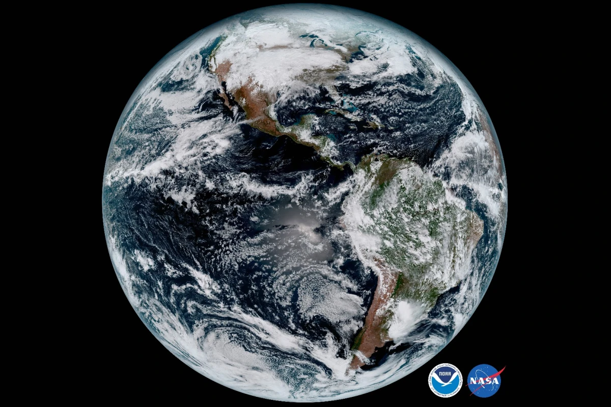
The National Oceanic and Atmospheric Administration (NOAA) has released the first batch of images taken by the GOES-16 satellite, including a breath-taking image of Earth's full disk. GOES-16 will play a vital role in the effort to provide early warnings for potentially dangerous weather systems, and aid in the planning of humanitarian efforts undertaken in the wake of natural disasters.

GOES-16, which was launched at 6:42 p.m. EST on November 2016 is the first in a series of four planned cutting-edge geostationary weather satellites. NOAA's newest satellite (which was originally designated GOES-R) will be followed by GOES-S, -T and -U.

Once operational, GOES-16 will supplement the existing fleet of satellites responsible for feeding data to NOAA from orbit, which includes the older GOES East and West probes, Jason-3, and NASA's DSCOVR spacecraft.

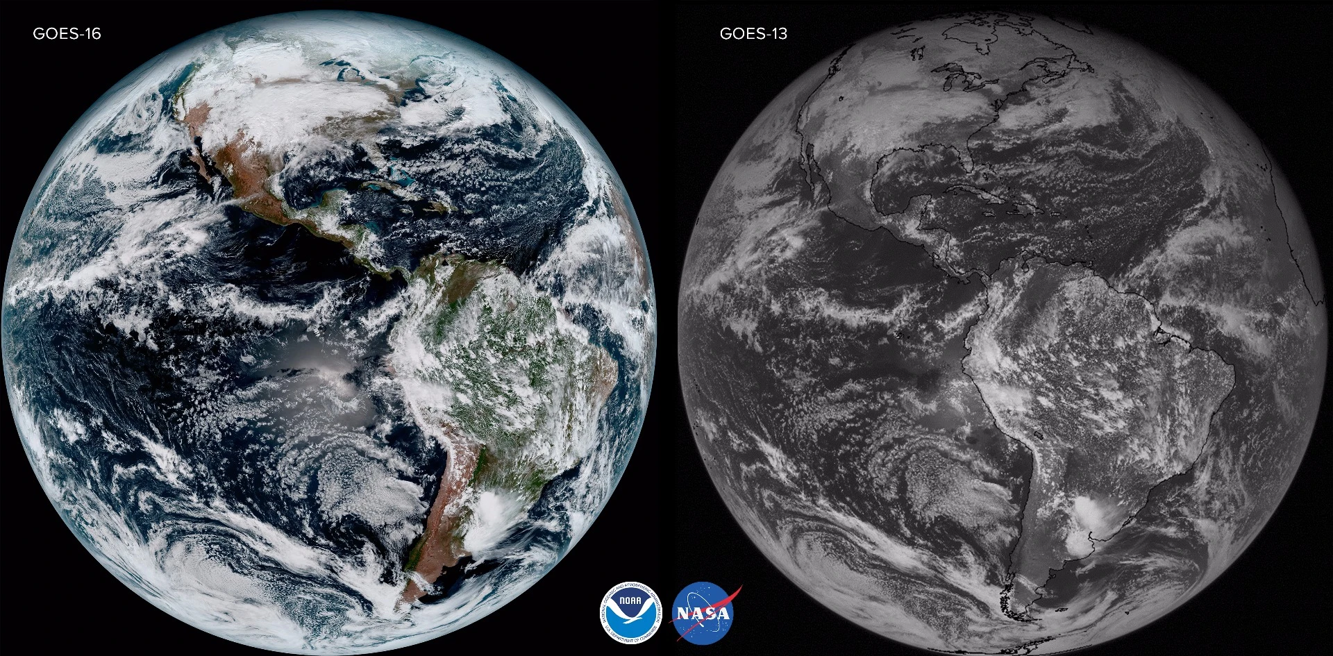
According to NASA, the advanced capabilities of the new GOES satellites will be the equivalent of going from black and white television to HDTV in terms of weather forecasting.

Alongside an advanced capability to track and forecast thunderstorms, tornadoes and hurricanes, the GOES-16 is tasked with numerous other duties. These include keeping an eye out for potentially harmful space weather, monitoring air quality and volcanic eruptions, and tracking the progress of forest fires. The satellite will also assist in providing information that will help to guide humanitarian relief efforts in the wake of a natural disaster.

Positioned roughly 22,300 mi (35,888 km) from our planet's surface, GOES-16 is capable of imaging Earth's full disk once every 15 minutes, or of capturing specific regional events once every 30 seconds – roughly five times faster than the previous GOES satellites.

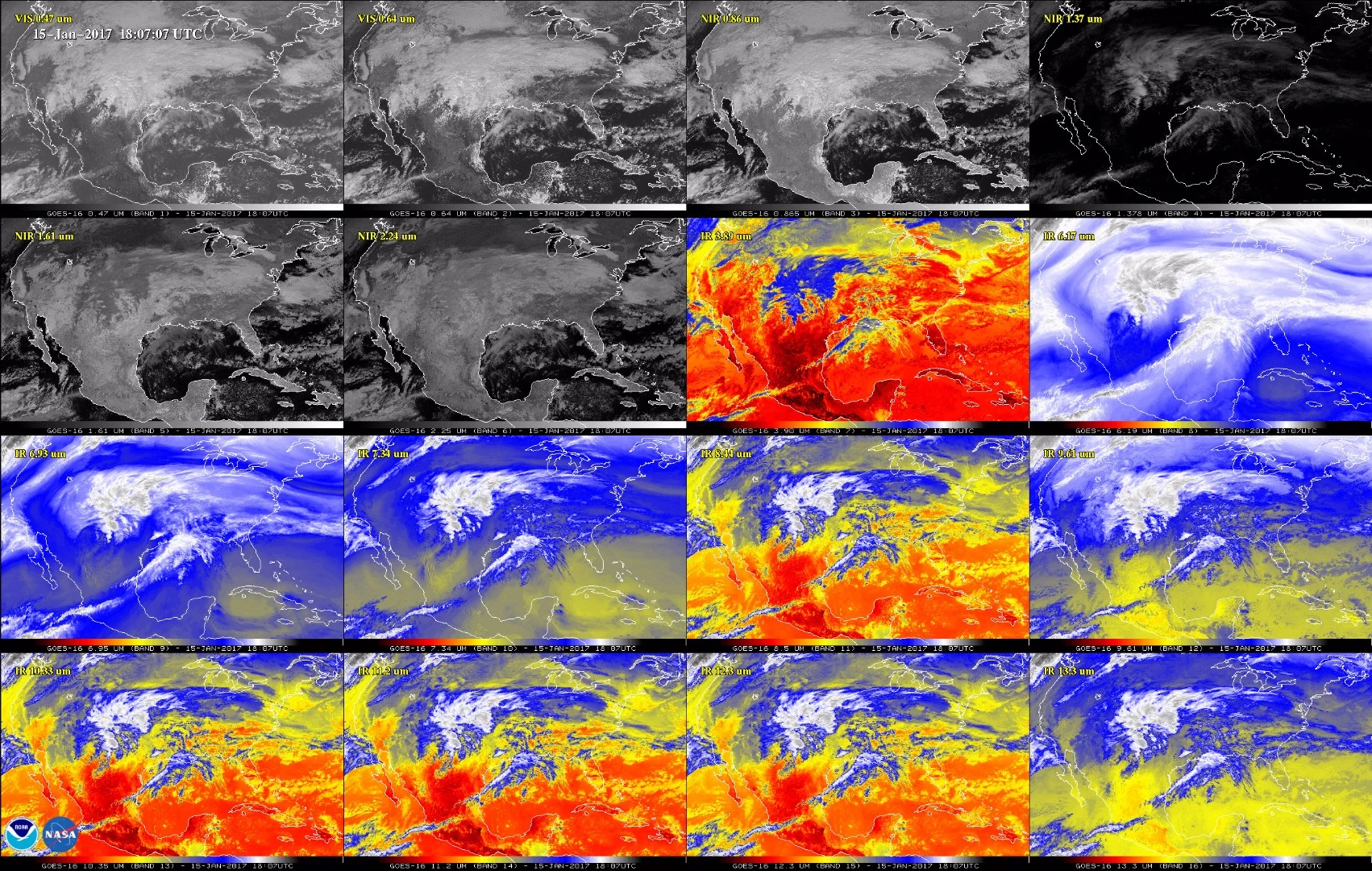
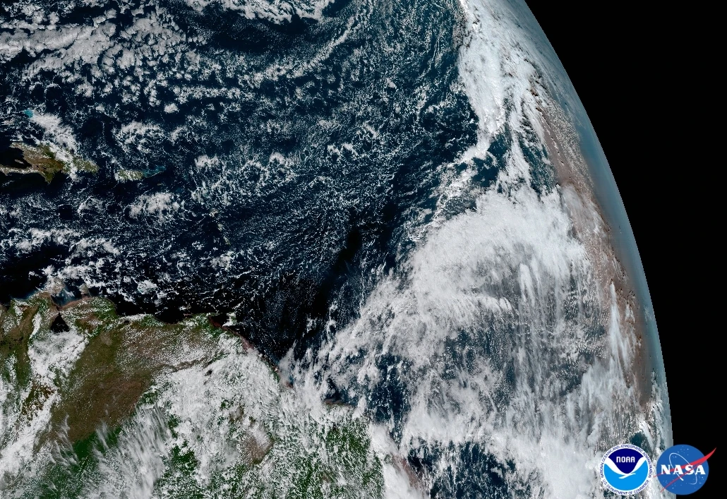
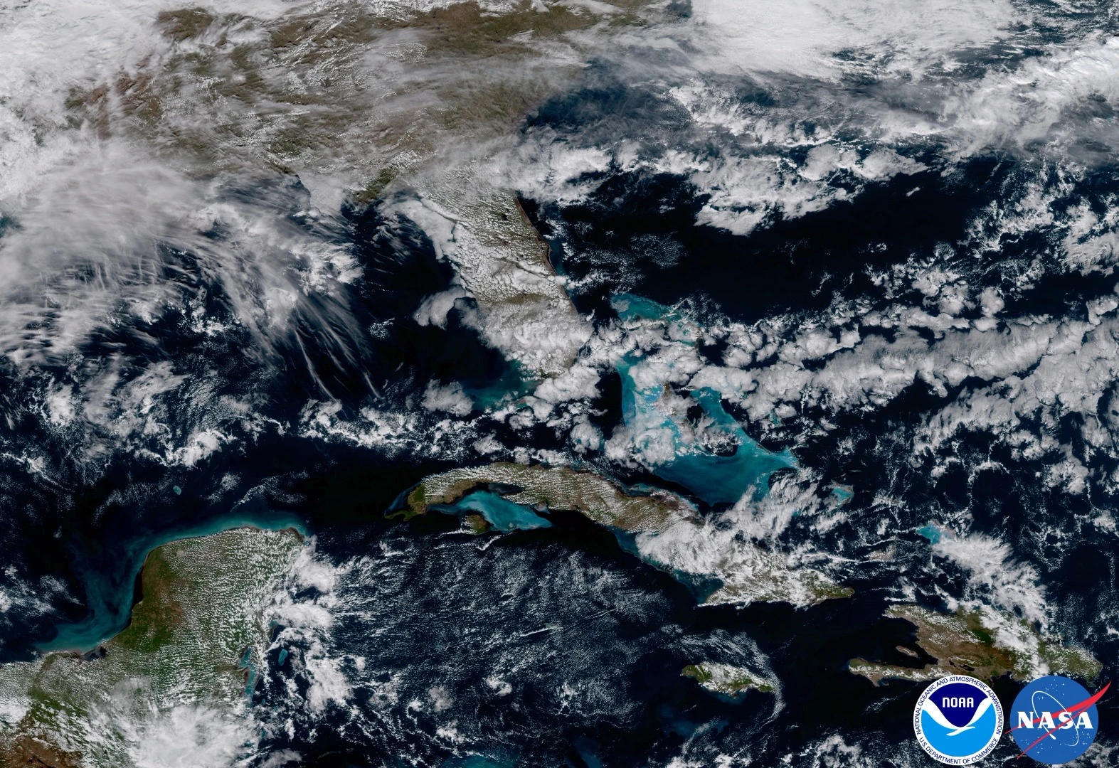
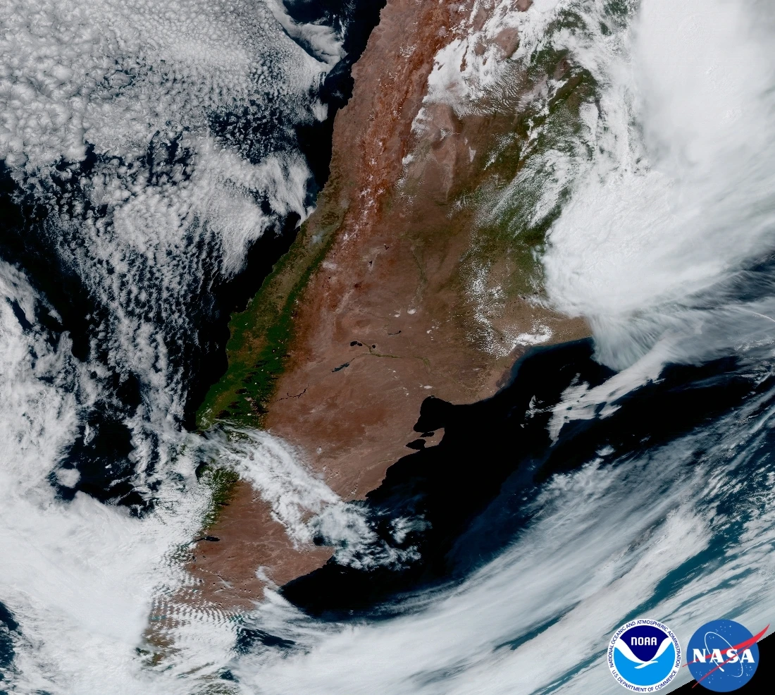
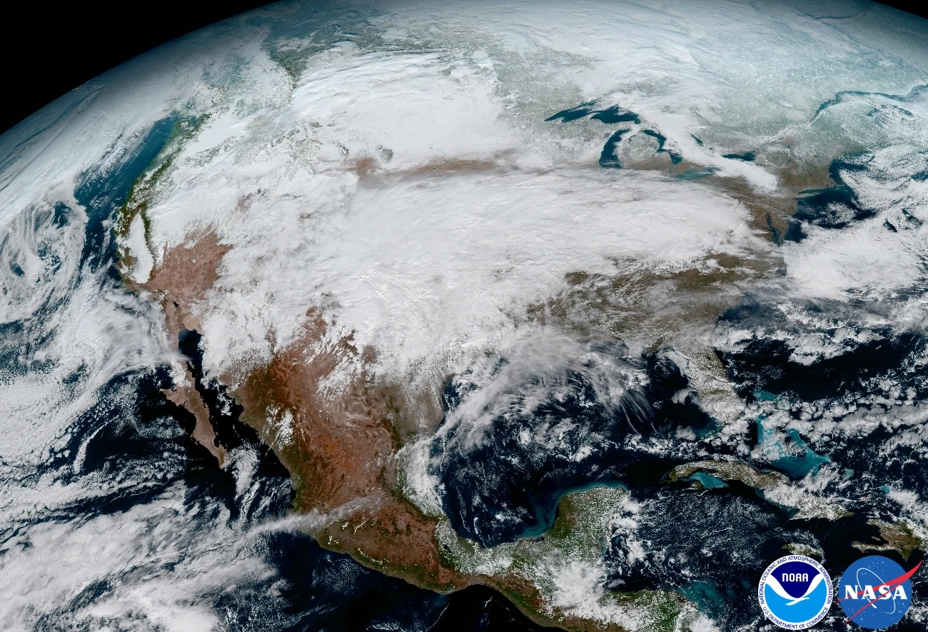
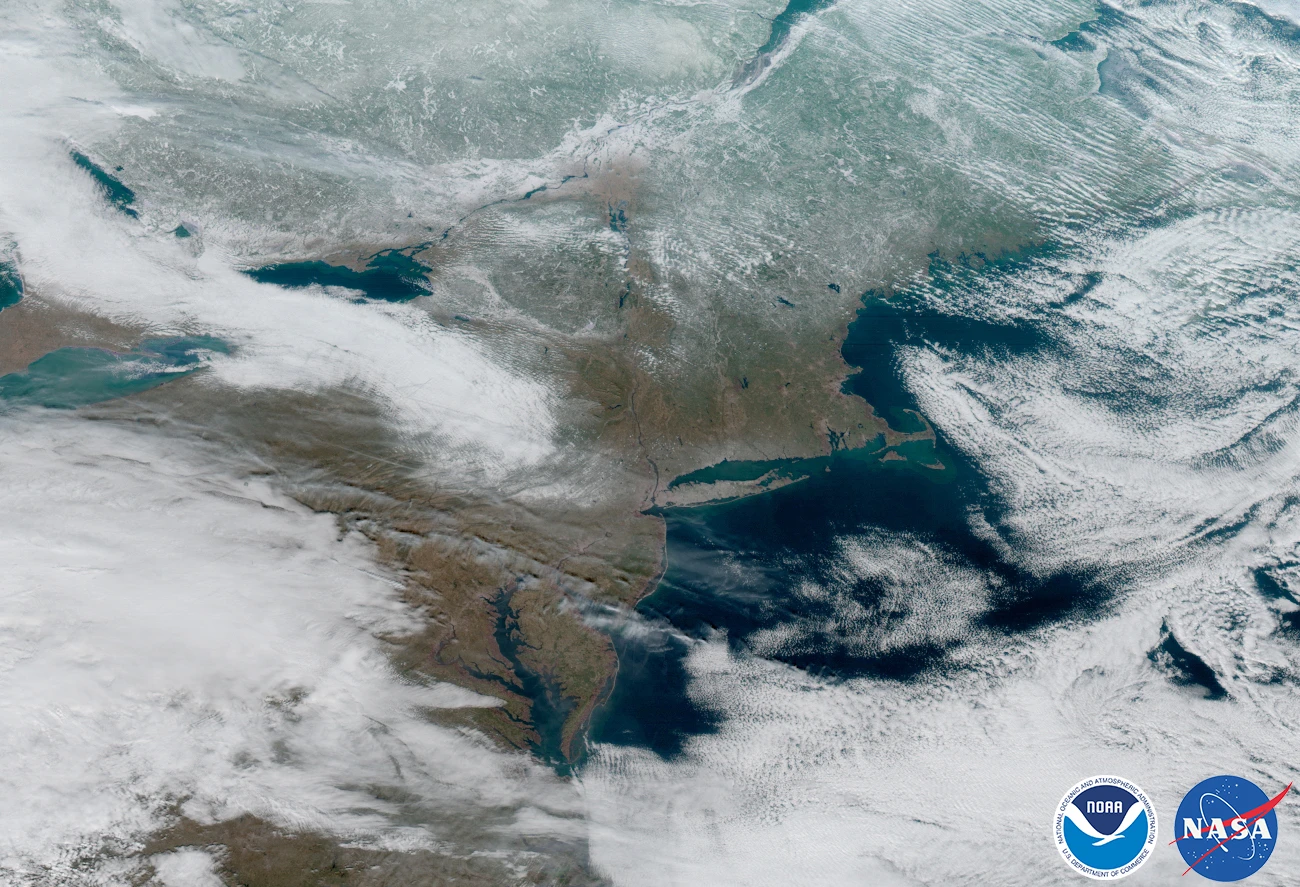
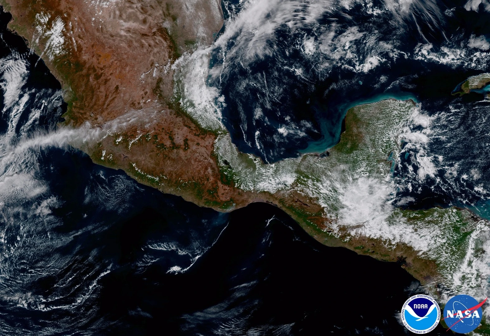
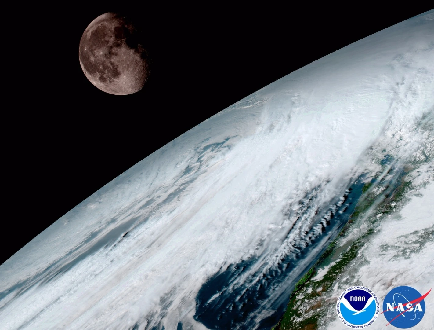
The first set of images were snapped with the probe's Advanced Baseline Imager (ABI) Instrument. ABI boasts four times the spatial resolution of its predecessor GOES imagers, and is capable of capturing data across 16 spectral channels which combine to create stunning and informative Earth imagery.

A GOES-16 calibration image displaying the Moon hanging above the cloud-covered surface of Earth
A GOES-16 calibration image displaying the Moon hanging above the cloud-covered surface of Earth

NASA, and NOAA, believe that the advanced capabilities of the new GOES satellites will remain in operation beyond late 2036.

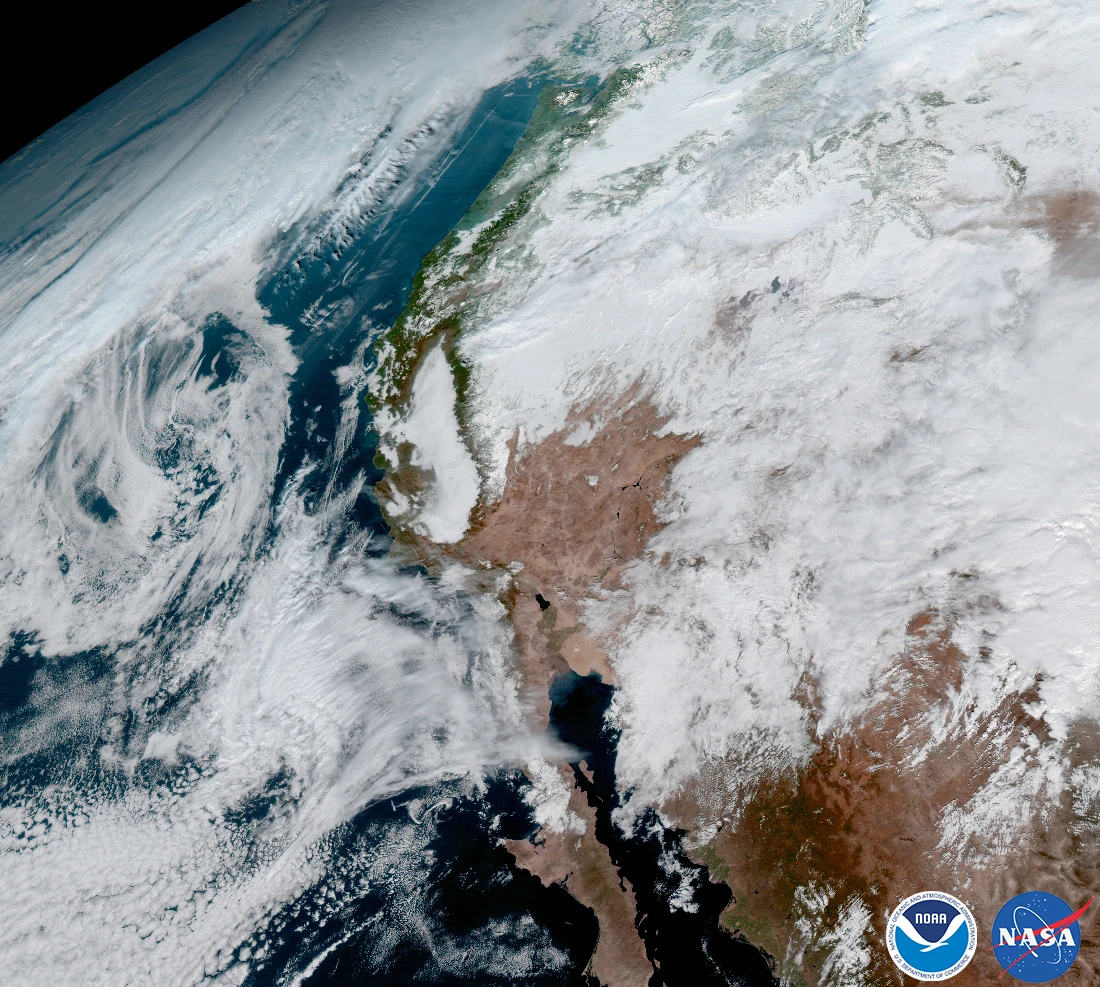
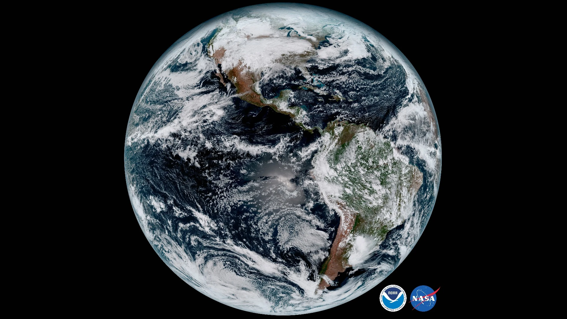
The first image release from GOES-16 stands as testament to the satellite's observational power. Included in the release is a stunning shot of Earth's full disk, featuring our planet's Western Hemisphere wreathed in cloud. Take a look at the gallery to see all ten of GOES-16's stunning images of Earth.

"The image is much more than a pretty picture, it is the future of weather observations and forecasting," said Louis W. Uccellini, Ph.D, director of NOAA's National Weather Service in Silver Spring, Maryland. "High resolution imagery from GOES-16 will provide sharper and more detailed views of hazardous weather systems and reveal features that previous instruments might have missed, and the rapid-refresh of these images will allow us to monitor and predict the evolution of these systems more accurately."

Source: The National Oceanic and Atmospheric Administration

View gallery - 11 images
2 comments
2 comments
JohnDixon
Are these fake because I can't see 1 star in the 1 photo that I should see lots
Augure
This looks like an artist impression, a bad one with oversaturated colors, of the satellite photo....