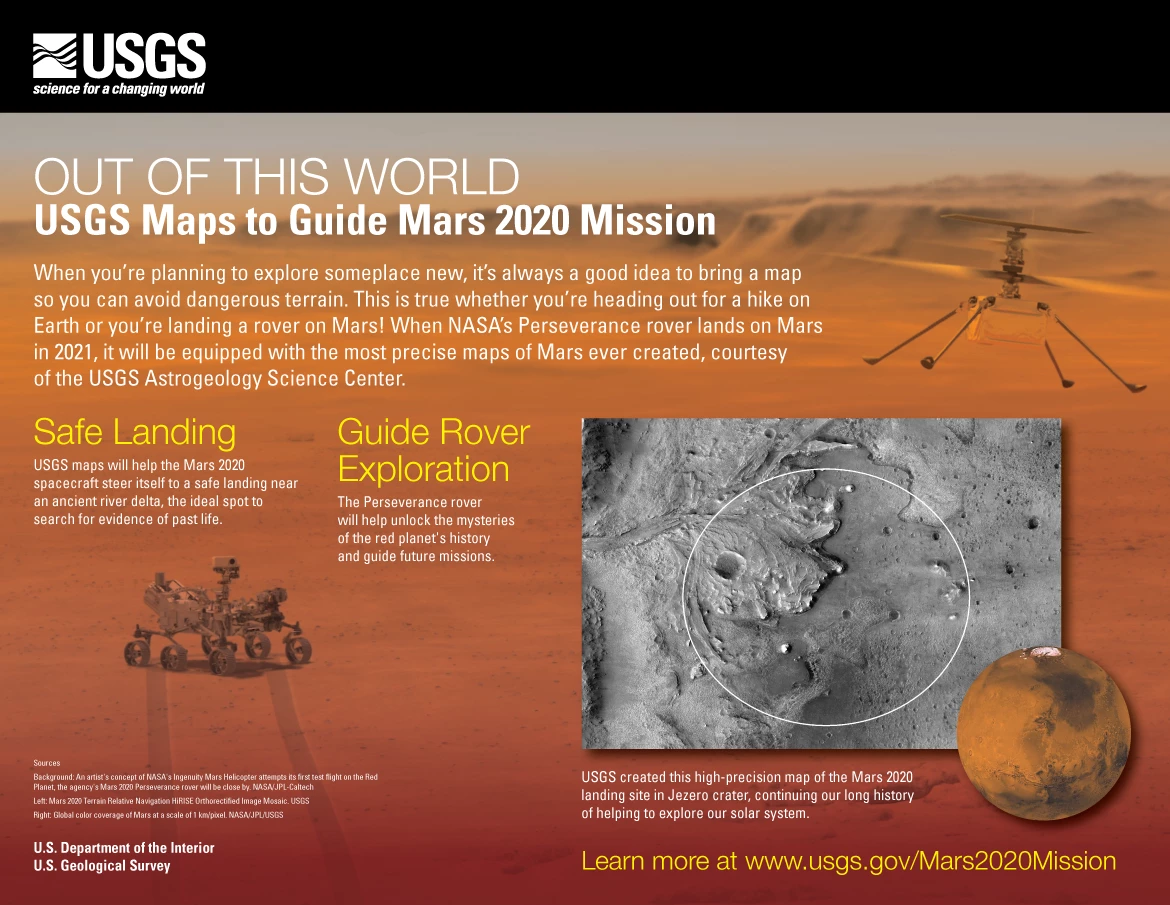
When NASA's Perseverance Mars rover touches down on the Red Planet on February 18, 2021, its descent stage will guide it autonomously to a (hopefully) safe landing thanks to a pair of the most precise Martian maps ever produced.
Though spacecraft have been landing successfully on Mars since the 1970s, it's still about as risky an exercise as one could imagine with a depressingly high failure rate. One reason a soft landing is so difficult is that the spacecraft cannot be guided manually and must carry out all the maneuvers by relying on the instructions programmed into the onboard computer.
Scheduled to launch on July 28, 2020, the Mars 2020 spacecraft, of which the Perseverance rover is the centerpiece, will be 130 million mi (209 million km) from Earth when it starts its descent. At this distance, it will take a signal from Earth almost 12 minutes to reach Mars, so the spacecraft must handle all of its piloting and navigation on its own, but it will have an advantage over earlier missions.
Where previous efforts had to rely on large elliptical landing areas on maps drawn from low-resolution images, Mars 2020 will be much more precise. It will have new maps drawn up by the United States Geological Survey's (USGS) Astrogeology Science Center, based on images from NASA's Mars Reconnaissance Orbiter’s Context Camera and the High-Resolution Imaging Science Experiment (HiRISE) camera which will exceed the accuracy of anything that has come before.

One is a high-resolution, 25-cm (9.8-in) per pixel map that accurately pinpoints the surface hazards around the landing site. The other is a lower-resolution, six-meters (20-ft) per pixel map. This, along with the first map, will be used by the onboard computer for Terrain Relative Navigation, where cameras will compare images of the surface with the maps to tell the spacecraft where it is, and help it to decide how best to land safely in Mars' Jezero crater.
According to the USGS, these are not only the most accurate maps made of Mars, but they also align with one another and with global maps of the planet with unprecedented precision. After the rover is deployed, the maps will help it to navigate as it begins its mission to be the first Mars lander to seek out direct signs of life since the Viking missions of 1976. As part of this, the rover will also collect samples and attempt to store them in caches for later collection and analysis. All going to plan, it will be the first demonstration of this so-called "sample caching" on Mars.
"Exploration is part of human nature and USGS has a long history and enduring interest in researching planets other than our own," says USGS director and former NASA astronaut Jim Reilly. "These maps will help the Perseverance mission unlock the mysteries of the red planet's past and guide future missions."
Source: USGS


