Photography

Aerial photography captures the beauty of how water shapes our planet

Aerial photography captures the beauty of how water shapes our planet
Low tide at blue hour reveals a muddy riverbed of fishbone shaped streams in the middle of a small, but unique part of the salt marsh located at the end of the Betanzos Estuary, near Coruna in northern Spain
View 21 Images
Low tide at blue hour reveals a muddy riverbed of fishbone shaped streams in the middle of a small, but unique part of the salt marsh located at the end of the Betanzos Estuary, near Coruna in northern Spain
1/21
Low tide at blue hour reveals a muddy riverbed of fishbone shaped streams in the middle of a small, but unique part of the salt marsh located at the end of the Betanzos Estuary, near Coruna in northern Spain
Marshland of Cadiz Bay at blue hour. Cadiz, Spain
2/21
Marshland of Cadiz Bay at blue hour. Cadiz, Spain
Harvested wheat leaves an abstract pattern reminiscent of antlers spreading through this hilly territory in this desert region, thanks to the outlines of former wetlands in Aragon, Burgo de Ebro, Spain
3/21
Harvested wheat leaves an abstract pattern reminiscent of antlers spreading through this hilly territory in this desert region, thanks to the outlines of former wetlands in Aragon, Burgo de Ebro, Spain
Textures at an abandoned pond used for the disposal and stacking of phosphogypsum with shallow, but highly toxic radioactive green water in Huelva, Southern Spain
4/21
Textures at an abandoned pond used for the disposal and stacking of phosphogypsum with shallow, but highly toxic radioactive green water in Huelva, Southern Spain
Network of channels in estuary of River Zala, Hungary
5/21
Network of channels in estuary of River Zala, Hungary
Traces of a disappeared river. Spain, Cantillana.
6/21
Traces of a disappeared river. Spain, Cantillana.
Spanish orange plantations. Farmers have devised a system of hill-terracing and cut irrigation channels to every stair on hill slopes which are fed by powerful water pumps
7/21
Spanish orange plantations. Farmers have devised a system of hill-terracing and cut irrigation channels to every stair on hill slopes which are fed by powerful water pumps
Solnana Nin. Salt farms in Nin, Croatia
8/21
Solnana Nin. Salt farms in Nin, Croatia
Picnic boats in front of the fascinating swirling tidal channels in the middle of the Venice lagoon seen from above
9/21
Picnic boats in front of the fascinating swirling tidal channels in the middle of the Venice lagoon seen from above
Water is missing here, but the shapes were made by lava flowing from the Laki Eruption in 1783. Iceland
10/21
Water is missing here, but the shapes were made by lava flowing from the Laki Eruption in 1783. Iceland
Tidal streams of the San Pedro rive in Cadiz, Spain
11/21
Tidal streams of the San Pedro rive in Cadiz, Spain
Amazing puzzle system of stone walls, built by humans in the last century to keep water on small grape and olive parcels, to hold the soil and to protect plants from the winter winds. Croatia
12/21
Amazing puzzle system of stone walls, built by humans in the last century to keep water on small grape and olive parcels, to hold the soil and to protect plants from the winter winds. Croatia
Shapes made by tidal streams in the Venice lagoon, Italy
13/21
Shapes made by tidal streams in the Venice lagoon, Italy
Galesnjak Island, Turany, Croatia
14/21
Galesnjak Island, Turany, Croatia
Bizarre sand formation between beaches, muddy plains and marshes over a large estuary of Cadiz Bay, around salt marsh of Isla Trocadero created by action of the sea and fluvial sediments deposited over centuries. Cadiz Bay, Puerto Real, Southern Spain
15/21
Bizarre sand formation between beaches, muddy plains and marshes over a large estuary of Cadiz Bay, around salt marsh of Isla Trocadero created by action of the sea and fluvial sediments deposited over centuries. Cadiz Bay, Puerto Real, Southern Spain
Geyser in Haukadalslaug Valley, Iceland
16/21
Geyser in Haukadalslaug Valley, Iceland
Colorful grasses and swirling tidal channels on one of the 62 small islands in the salt marshes of Lagoon Venice, the largest wetland in the Mediterranean Basin, Venice, Area Lio Piccolo, Italy
17/21
Colorful grasses and swirling tidal channels on one of the 62 small islands in the salt marshes of Lagoon Venice, the largest wetland in the Mediterranean Basin, Venice, Area Lio Piccolo, Italy
Sand reef on the Atlantic coast, France
18/21
Sand reef on the Atlantic coast, France
Receding iceberg, Iceland
19/21
Receding iceberg, Iceland
Traces of disappeared rivers in Cantillana, Spain
20/21
Traces of disappeared rivers in Cantillana, Spain
Half-marsh, half-hotel, Spain
21/21
Half-marsh, half-hotel, Spain
View gallery - 21 images

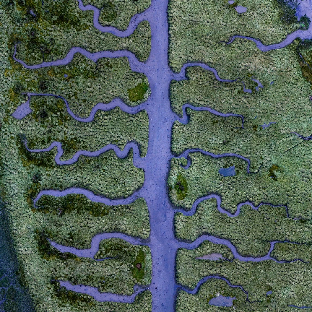
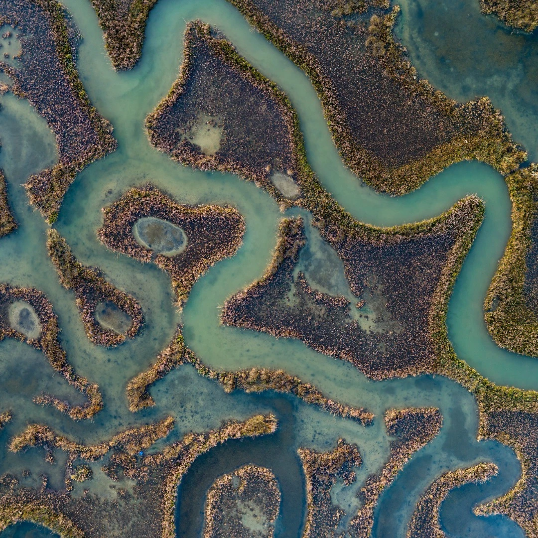
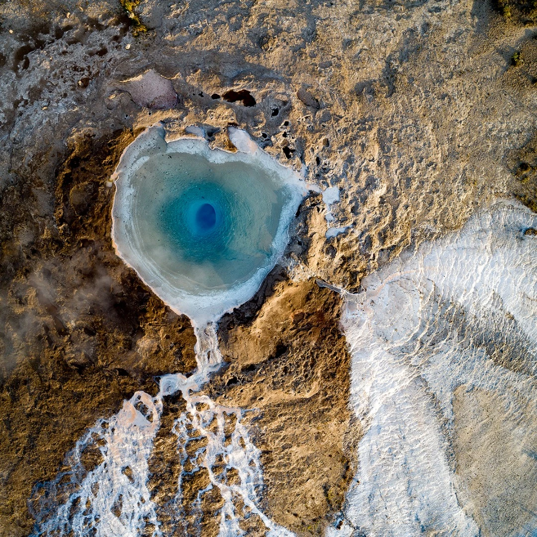
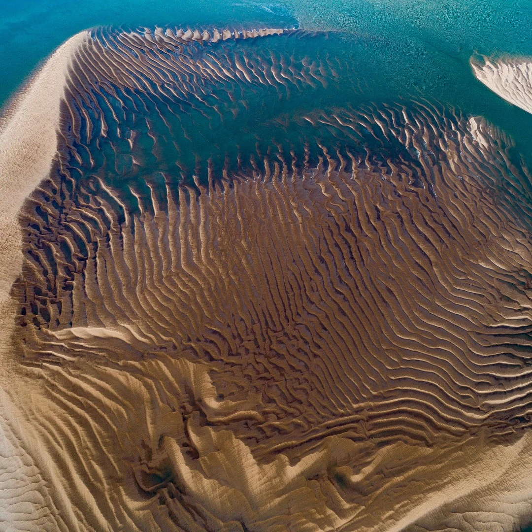
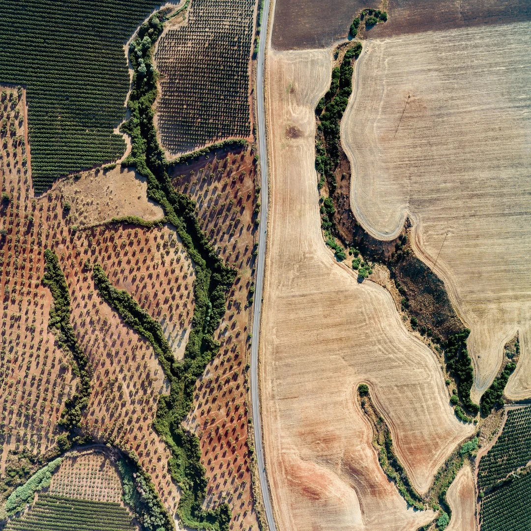
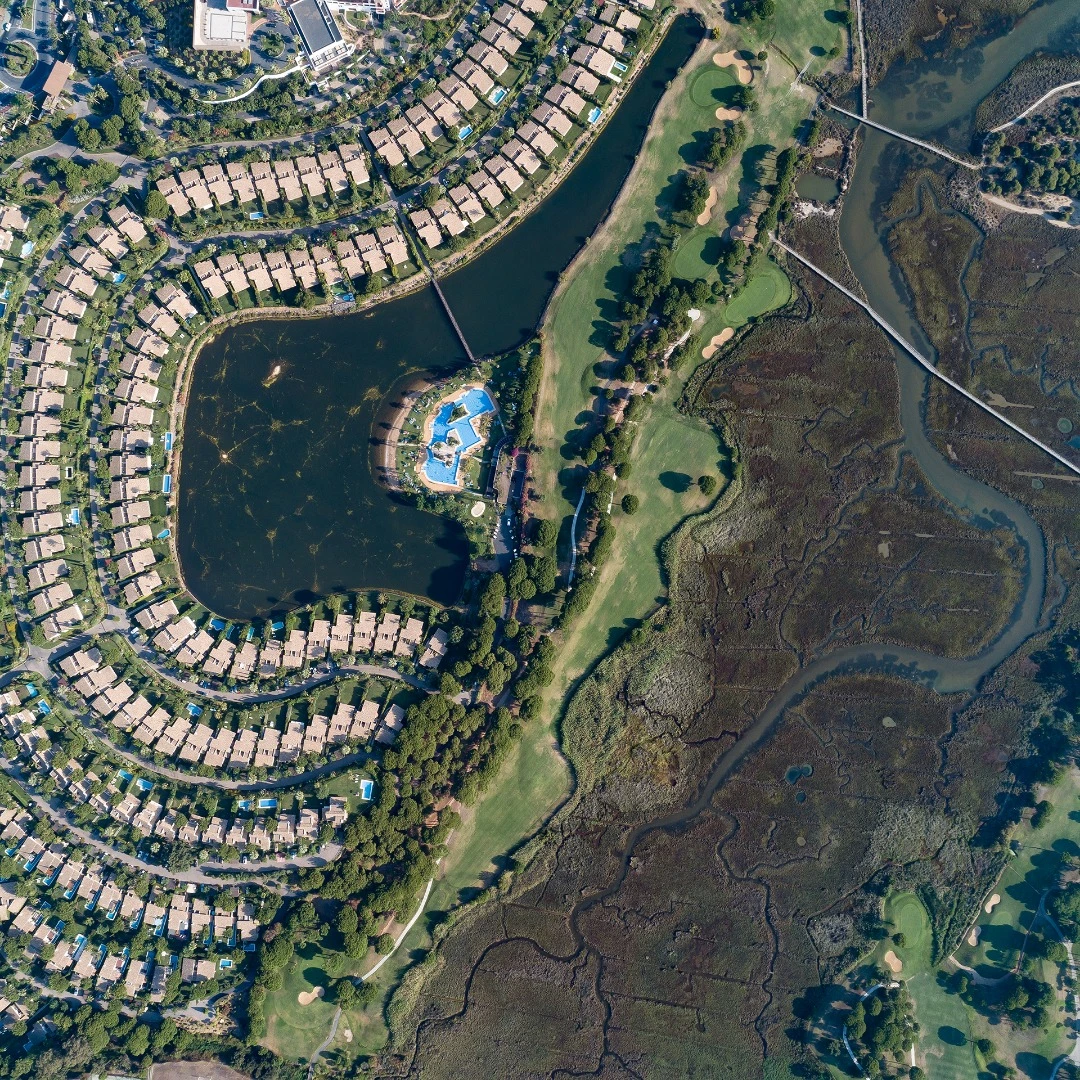
Water.Shapes.Earth is a spectacular photographic project from veteran artist and storyteller Milan Radisics. The project tells the story of how water shapes the planet by using aerial photography to deliver a series of stunning images that sit on the border between abstract art and documentary realism.

The ongoing series currently spans eleven countries and while, so far, the project has centered mainly on European locations, Radisics is planning on photographing areas of Africa, South America and India in the very near future.

Colorful grasses and swirling tidal channels on one of the 62 small islands in the salt marshes of Lagoon Venice, the largest wetland in the Mediterranean Basin, Venice, Area Lio Piccolo, Italy
Colorful grasses and swirling tidal channels on one of the 62 small islands in the salt marshes of Lagoon Venice, the largest wetland in the Mediterranean Basin, Venice, Area Lio Piccolo, Italy

The project is structured as a story with seven primary chapters, or topics. These topics cover the entire story of Earth and water, beginning with melting glaciers and ending with drought that has left us with the patterns and remnants of long lost streams and rivers.

Research for each prospective photographic location begins with a large scout using Google Earth. "For each selected region," Radisics explains, "I scan through the satellite pictures. That way, after hours of research, I may come across something truly remarkable which is also appropriate for the project. When this occurs, I dive into the location and continue the search personally on site."

Traces of disappeared rivers in Cantillana, Spain

While the project does have an overt environmental message, Radisics is not interested in pushing a specific ideology through his work. "I am not a guy who wants to fight by demonstration on the streets," he says. "I believe in the power of aesthetics."

The Water.Shapes.Earth project is one that Radisics sees as both artistic self-expression and journalistic document. This is inspiring visual storytelling designed to proffer a sense of awe in the viewer, and Radisics hopes the work will maybe move some people to reconsider their approach to conservation and our place on this fragile planet.

Textures at an abandoned pond used for the disposal and stacking of phosphogypsum with shallow, but highly toxic radioactive green water in Huelva, Southern Spain

Take a look through our gallery at some more of this magnificent aerial photography.

Source: Water.Shapes.Earth / Instagram

View gallery - 21 images
No comments
0 comments
There are no comments. Be the first!